The Pyongyang-Kaesong highway and towns just north of Kaesong have suffered major flood damage after recent storms and subsequent swelling of the Ryesong River, satellite images from Planet Labs reveal.
An NK News review of the imagery follows a report published by the UN Office for the Coordination of Humanitarian Affairs (OCHA) on Monday, which said that 76 people had died in the area as a result of heavy rains and flooding.
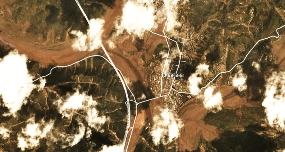
Become a member for less
than $5.75 per week.
Unlimited access to all of NK News: reporting, investigations, analysis
The NK News Daily Update, an email newsletter to keep you in the loop
Searchable archive of all content, photo galleries, special columns
Contact NK News reporters with tips or requests for reporting
Get unlimited access to all NK News content, including original reporting, investigations, and analyses by our team of DPRK experts.
Subscribe now
All major cards accepted. No commitments – you can cancel any time.