

|
News North Korean rocket launch site, villages flooded as state media silentSoldiers mobilized to build homes by hand in some areas affected by August floods, but others yet to see relief
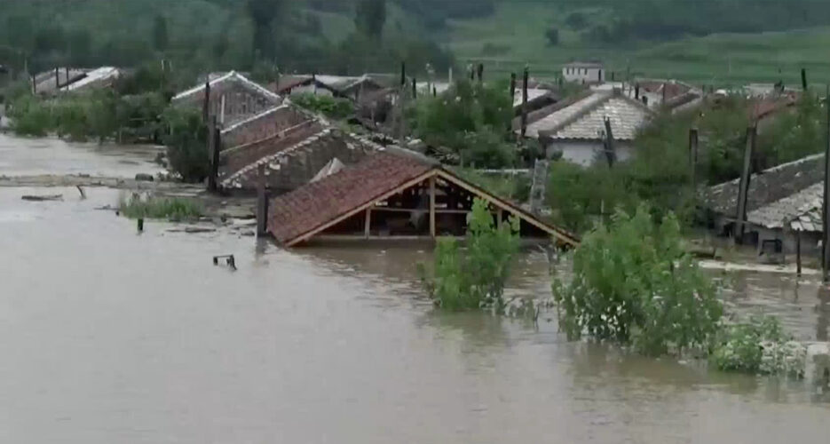 More heavy rains in August have wiped out North Korean villages, damaged a key missile and satellite launching base and destroyed a major rail bridge for the second time in a 12-month period in the country’s northeastern region, according to NK News analysis of satellite imagery. State-run media has so far remained silent on the latest devastation, which comes after NK News detailed extensive damage from earlier storms in parts of North and South Hamgyong provinces in the first week of August. As of Aug. 20, DPRK leader Kim Jong Un had only officially ordered recovery efforts in South Hamgyong, where soldiers are reportedly busy molding handmade bricks for new homes amid a shortage of supplies.  VILLAGES AND LAUNCH STATION DAMAGED While North Korean media is apparently ignoring the plight of thousands affected by a new round of storms between Aug. 5 and 15, state television did offer numbers on extremely high rainfall totals in the northeast region. According to Korean Central Television (KCTV), North Hamgyong province’s Hwadae county received 737 millimeters (29 inches) of rain and the town of Komusan in Puryong county saw 742 millimeters (29.2 inches) in the first half of the month. Planet Labs medium-resolution satellite imagery now reveals that these regions were indeed hit by flash floods. Rains were so heavy that small streams overflowed and much of the town of Hwadae and beachside villages nearby appeared inundated with water. 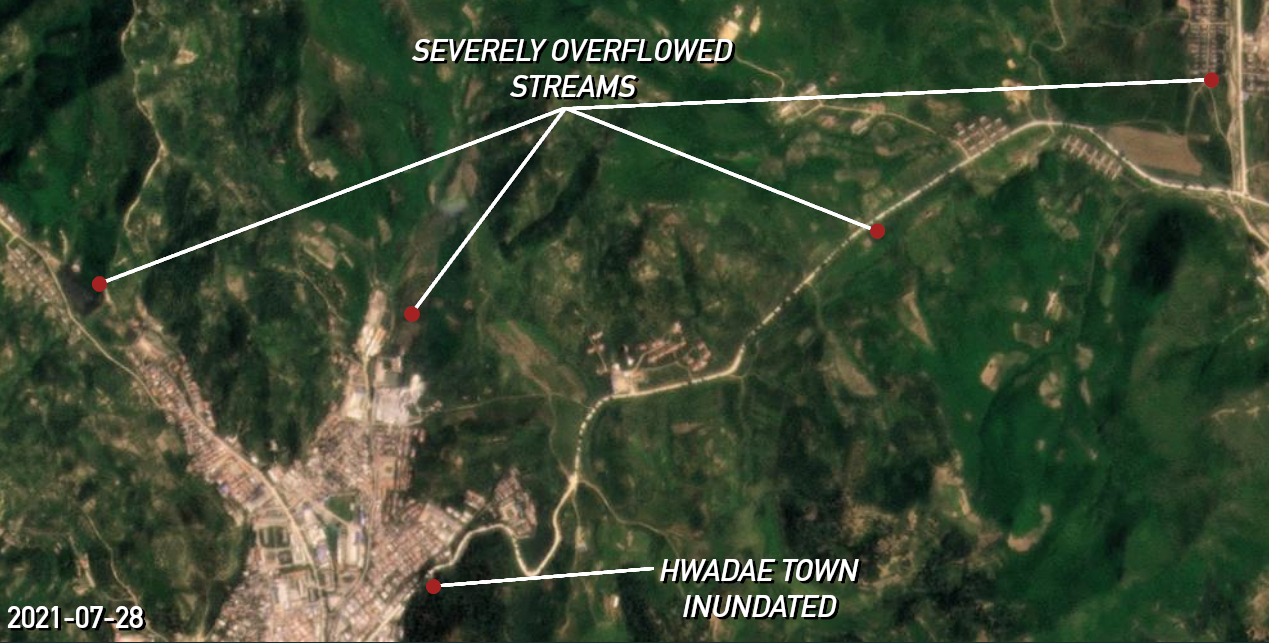 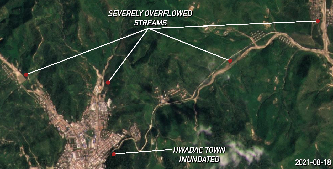 Coordinates: 40.847879°, 129.513423° 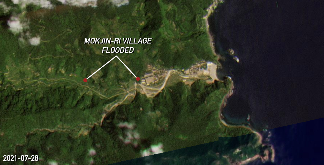 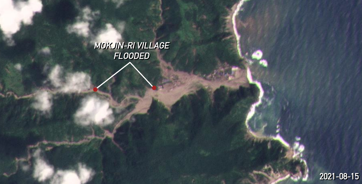 Coordinates: 40.915483°, 129.742807° The Tonghae Satellite Launching Ground in Hwadae’s Musudan-ri was also caught in the path of the raging waters, including what has been previously identified as a new administrative or launch control building built in the early 2010s and new houses or support buildings surrounding it that were built since 2018. The zone was used to launch a satellite into space in 2009 and for ballistic missile launches before that, but researchers have recently concluded that the site is dormant and is not likely to host a satellite or ballistic missile launch in the near future. 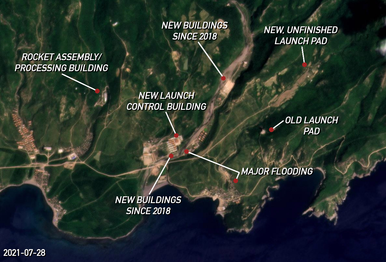  Coordinates: 40.852480°, 129.674352° Google Earth satellite imagery also reveals that the buildings flooded in Musudan-ri this month were built on the site of homes wiped out by floods between 2010 and 2012, following a tendency for North Korean authorities to rebuild in flood zones. Meanwhile, just north of Hwadae, North Korea’s underground nuclear test site known as Punggye-ri did not appear to be damaged by the recent storms in the latest Planet Labs imagery. BRIDGE DESTROYED, REBUILT, DESTROYED AGAIN Hoeryong, another major city in North Hamgyong that lies on the border with China, is also feeling the effects of the recent storms, according to Planet Labs imagery. The city, which was ravaged by storms one year ago and multiple times over the last decade, has seen its main rail bridge destroyed for the second time in 12 months. The bridge’s raised western section was wiped away by raging river waters in early Sep. 2020 and was rebuilt by early 2021, according to Google Earth and Planet Labs imagery. It appears authorities did not draft proper designs or workers did not have proper materials, because the same raised land section has once again disappeared, though the bridge support legs remain intact.  RECOVERY EFFORTS ELSEWHERE Sinhung county in South Hamgyong province saw the worst of storms between Aug. 1 and 2, and after North Korean leader Kim Jong Un reportedly told the military to conduct recovery efforts three days later, satellite imagery taken in recent days has revealed the first signs of rebuilding. At one location to the east of the main town of Sinhung, new structures have appeared in a large muddy area where an entire neighborhood and school stood just a few weeks ago. It is difficult to determine what kind of buildings they are due to the resolution of the images, but it may be another case of authorities rebuilding new homes in unprotected areas vulnerable to flooding during the next inevitable storm. KCTV has not shown the extent of new reconstruction, but it did show propaganda bands encouraging builders in Sinhung this week and scenes of handmade bricks drying in the sun that will soon be used to build new homes.   Meanwhile, the DPRK’s State Hydro-Meteorological Administration warned on KCTV earlier this week that the country may face two to three typhoons between late August and mid-September. In a major departure from last year, North Korean leader Kim Jong Un has so far stayed away from personally addressing the latest widespread devastation, besides making a behind-the-scenes order on Aug. 5. Kim has not made any new appearances in state media for 21 days, since July 30. Edited by Arius Derr. Updated at 1:40 KST on Aug. 21 to add an image of possible reconstruction work beginning in Sinhung. © Korea Risk Group. All rights reserved. |


 SHARE
SHARE COPY LINK
 X
X MASTODON


Recent Stories