
|
News Satellite imagery reveals scale of North Korean “marine rail” projectRailway aiming to connect new fishing hub completed at the end of May
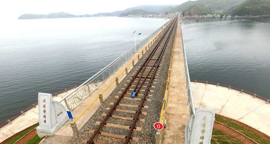 Satellite imagery has revealed the scale of an infrastructure project previously visited by Kim Jong Un and partially completed at the end of May. The project appears to involve two main components: a new railway line bridge and an expansive port set to serve as a hub for the fishing industry operating on the east coast of the DPRK. The first element of the project – the Koam-Tapchon marine railway bridge – was completed on May 31, according to the Korean Central News Agency (KCNA). “The Koam-Tapchon marine railway bridge was opened to traffic with due ceremony Wednesday in the DPRK,” an article published on the day read. “The construction of this Korean-style marine railway bridge in the eastern coastal area helps consolidate the material and technical foundation for the development of the country’s railway transport and fishing industry and provide the people with more convenient travel conditions,” it added.  The site had been previously visited by Kim on May 25, the same day that North Korea said it had closed the tunnels present at its nuclear test site in Punggye-ri. Despite the infrastructure project being referenced by KCNA as having been begun several years ago, state media does not appear to have reported on the site until May 25 this year, when Kim visited the location. According to Google Earth imagery, construction of the bridge first began in 2015, with very little progress being made until early 2017.  Over the course of the year, however, efforts to complete the rail line advanced rapidly, imagery from Planet Labs suggests, with both sides of the bridge appearing to have been connected in September. Looking west of the bridge, the railway line appears to join the wider DPRK transportation network at Okpyeong Station, which itself lies on a railway line that scales the east coast of the country. Opkyeong station is located around 20 kilometers from Wonsan. East of the bridge the newly laid rail line stops at a site of ongoing construction, which appears to be an expansive port located next to a small village. Satellite imagery also shows building works, on what appears to be the final station on the line, developing quickly in June 2017.  The port site will be a “large-scale fishing village zone in the areas of Koam, Tapchon and Chonapho favorable for developing the fishing industry” KCNA reported in May, with the Koam-Tapchon Railways acting “as a preceding process.” The pace of construction at the port appears to confirm this priority, with work having moved much more slowly than that of the railway bridge throughout 2017. From November, however, the North Koreans began making advanced progress on the construction of several new piers extending from the port. It remains unclear when the port site will be completed. Edited by Oliver Hotham Featured image: DPRK Today © Korea Risk Group. All rights reserved. |


 SHARE
SHARE COPY LINK
 X
X MASTODON


Recent Stories