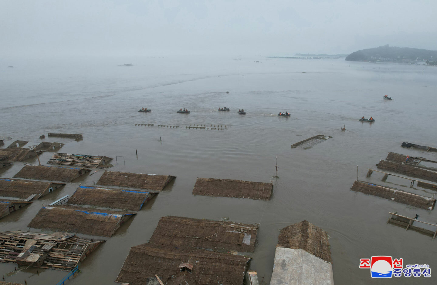
  Analysis Satellite images reveal devastating floods in North Korea, displacing thousandsEntire village wiped off map and transport links destroyed, while flooding at factories could disrupt weapons exports  Devastating floods in North Korea have wiped an entire village off the map and wreaked destruction along a river that runs through an area notorious for its weapons factories, according to NK Pro analysis of satellite imagery, indicating that the damage from recent heavy rains is much more severe than state media has let on. The major flooding in the mountainous Jagang and Ryanggang provinces along the Chinese border has likely displaced thousands of people and caused deaths, while likely disrupting weapons shipments to Russia. The revelations come after state media claimed 4,100 homes were damaged or destroyed and an unspecified number of people died in Sinuiju and Uiju counties of North Phyongan Province. The report included photos of leader Kim Jong Un touring multiple villages that were still underwater at least two days after a “record downpour” on July 27. Kim mobilized the military and young people to help recovery and rebuilding efforts in North Phyongan, and the military and party elites to Jagang and Ryanggang. While the ROK Red Cross has offered assistance, Pyongyang has not indicated any plans to accept or request international assistance, and is unlikely to employ such help in the sensitive weapons production region. 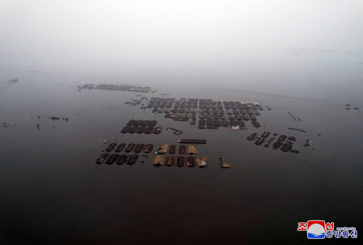
JAGANG PROVINCE Planet Labs satellite imagery shows evidence of extremely strong waters raging through Jagang Province’s capital Kanggye and south through Songgan and Jonchon counties, directly affecting some of the country’s most important munitions factories. The Jangja River appeared to surge through the province to Lake Jangjagang and the severely swollen Yalu River (Amnok River). The worst damage appears in Songgan County, with imagery showing the entire village of Kwangmyong-ri was washed away. This includes around 160 homes or duplexes, a school and various public buildings, a possible military base as well as roads, railroad tracks and bridges. The surging river appeared to leave a 330-foot (100-meter) wide path of destruction stretching across kilometers of small streams in this and other nearby areas. 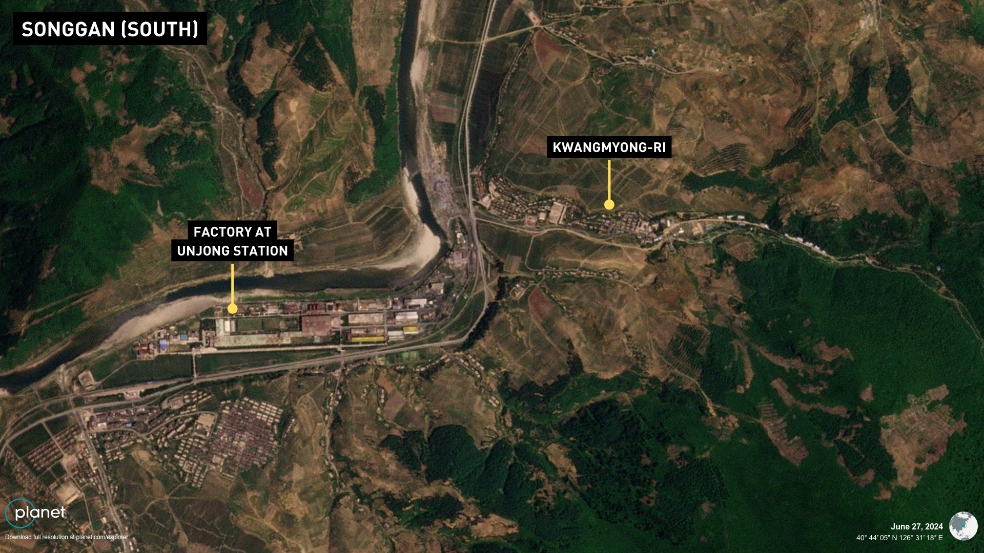
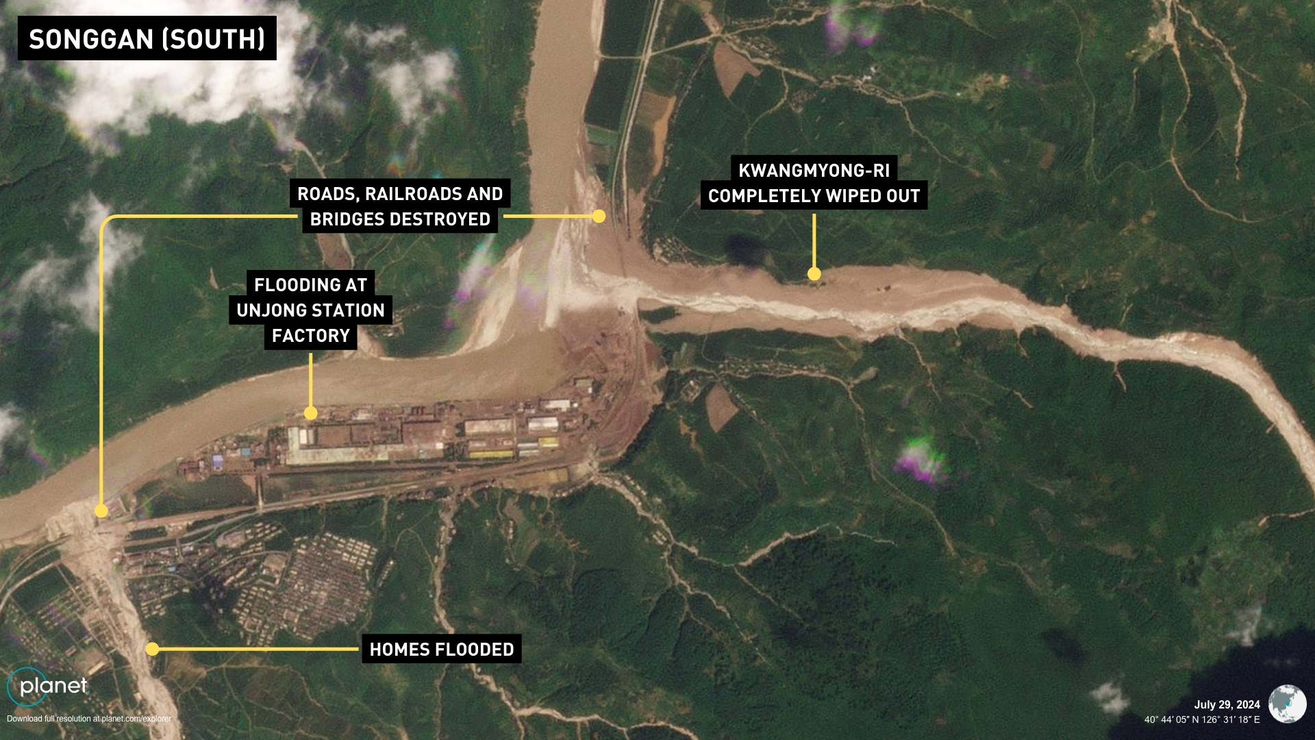
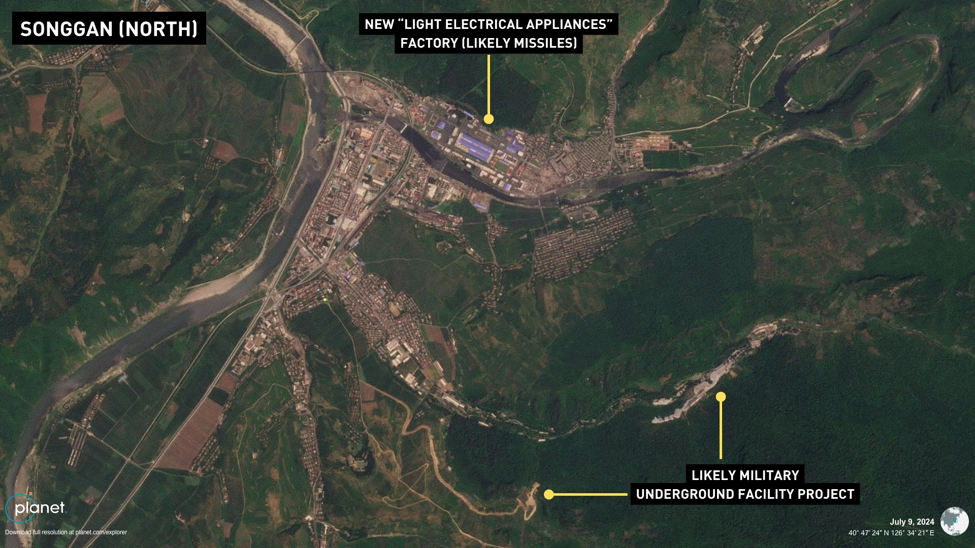
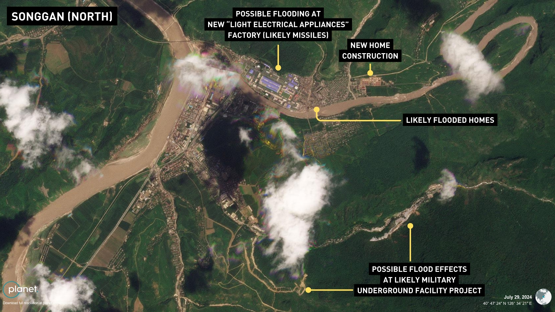
The destruction of transportation links between Songgan and Kanggye and the rest of the country is likely to hamper aid efforts for suffering residents and halt shipments from weapons factories. More homes, bridges and a large factory complex were also flooded or destroyed nearby at Unjong Station. Water appeared around the grounds of a brand new munitions factory further north in Songgan, and workers’ homes around the complex appear to have been damaged or destroyed. The plant was built rapidly in the last year, likely in relation to goals for exports to Russia, but specific evidence tying its products to Russia has yet to emerge. Water or landslides appear to have affected a new, likely military-related underground facility project nearby and the February General Steel Enterprise further south. Dozens of small homes also appeared damaged or destroyed to the east and along the river elsewhere in Songgan County. North of Songgan in the capital Kanggye, the main rail bridge crossing the river in the city center may have also been destroyed, imagery suggests, potentially cutting off the border city of Manpho to the north. 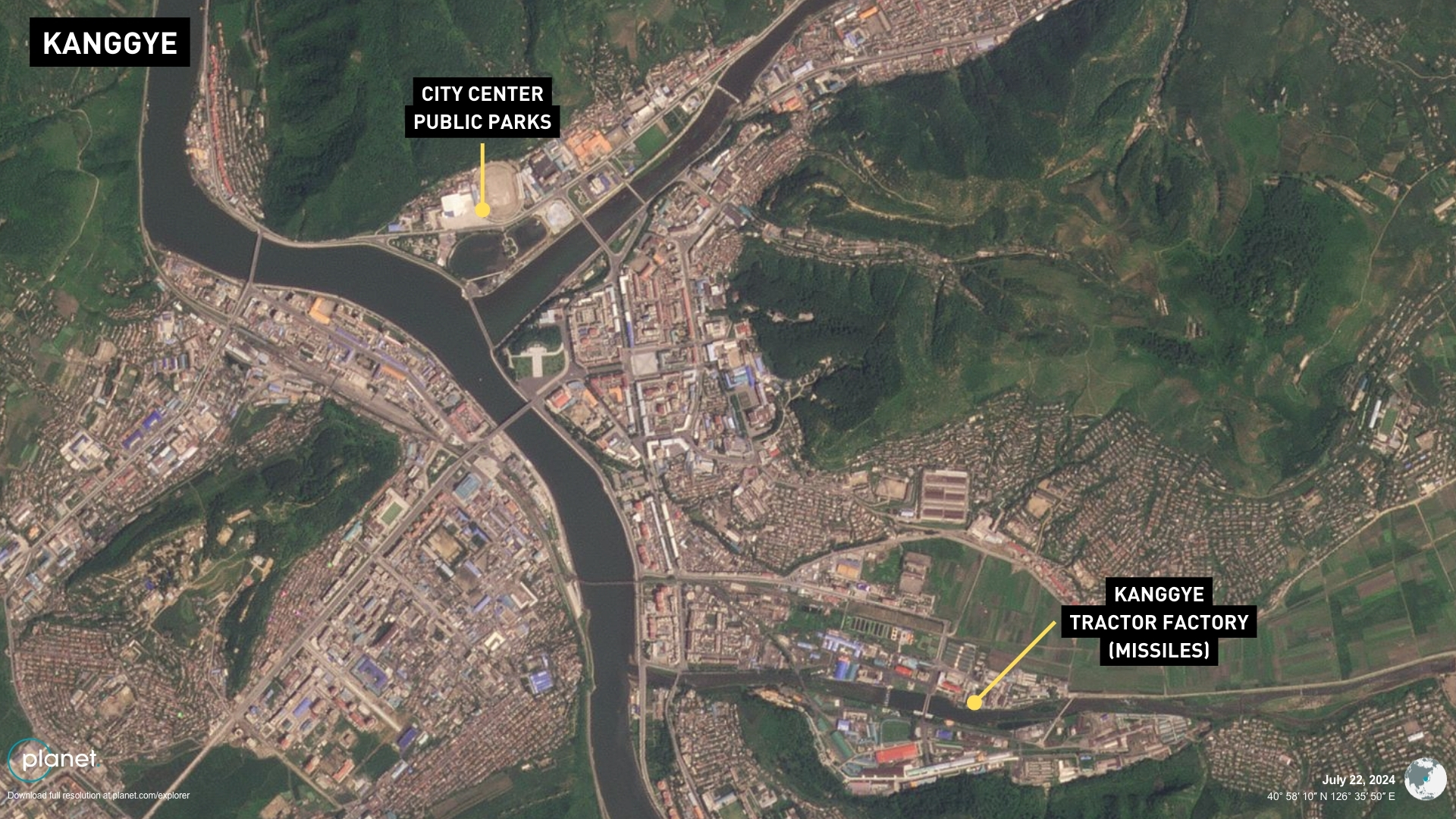
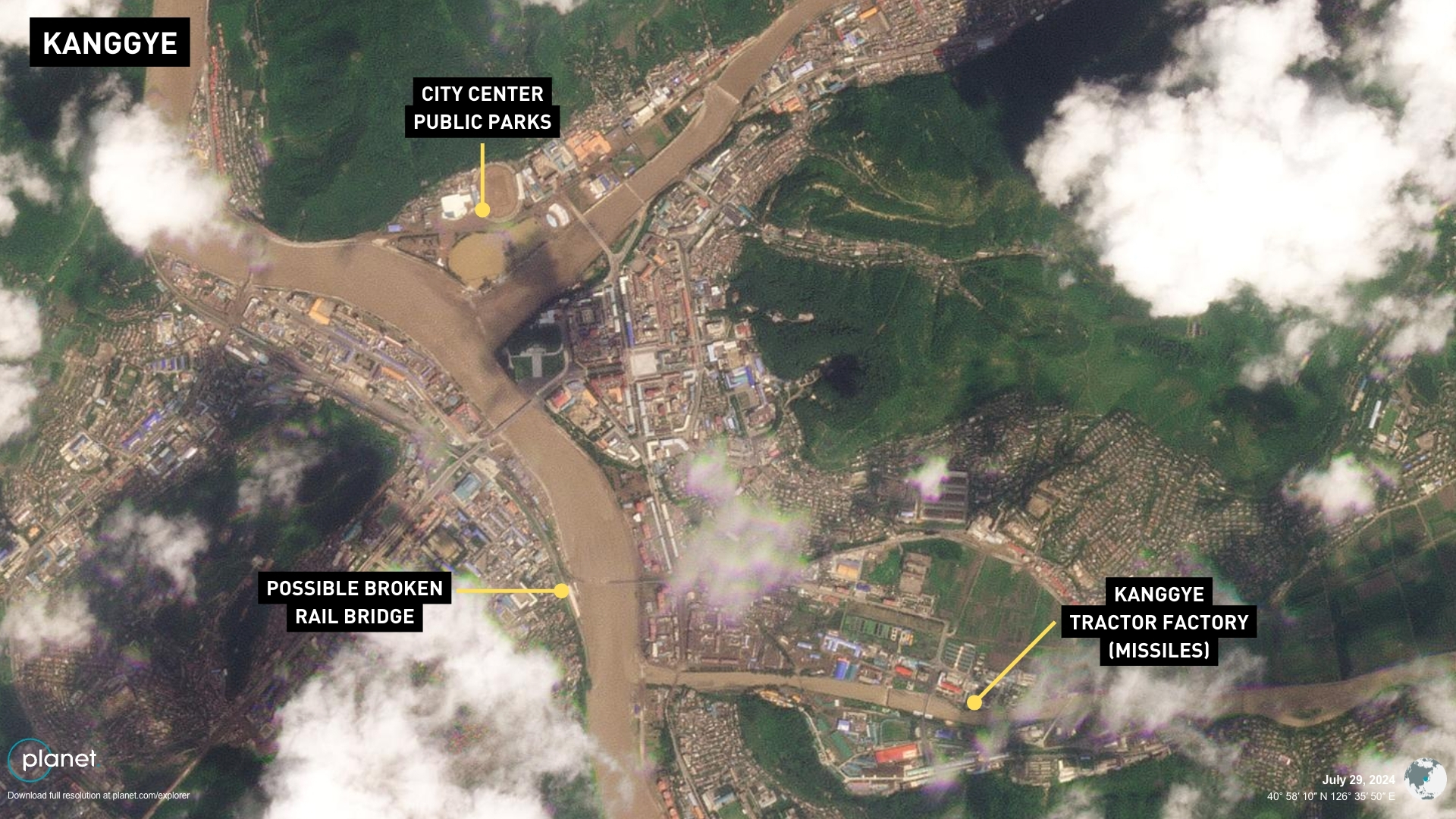
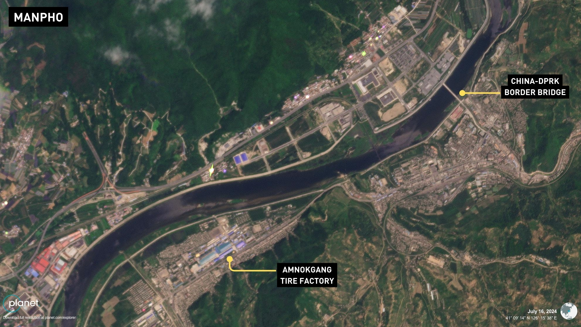
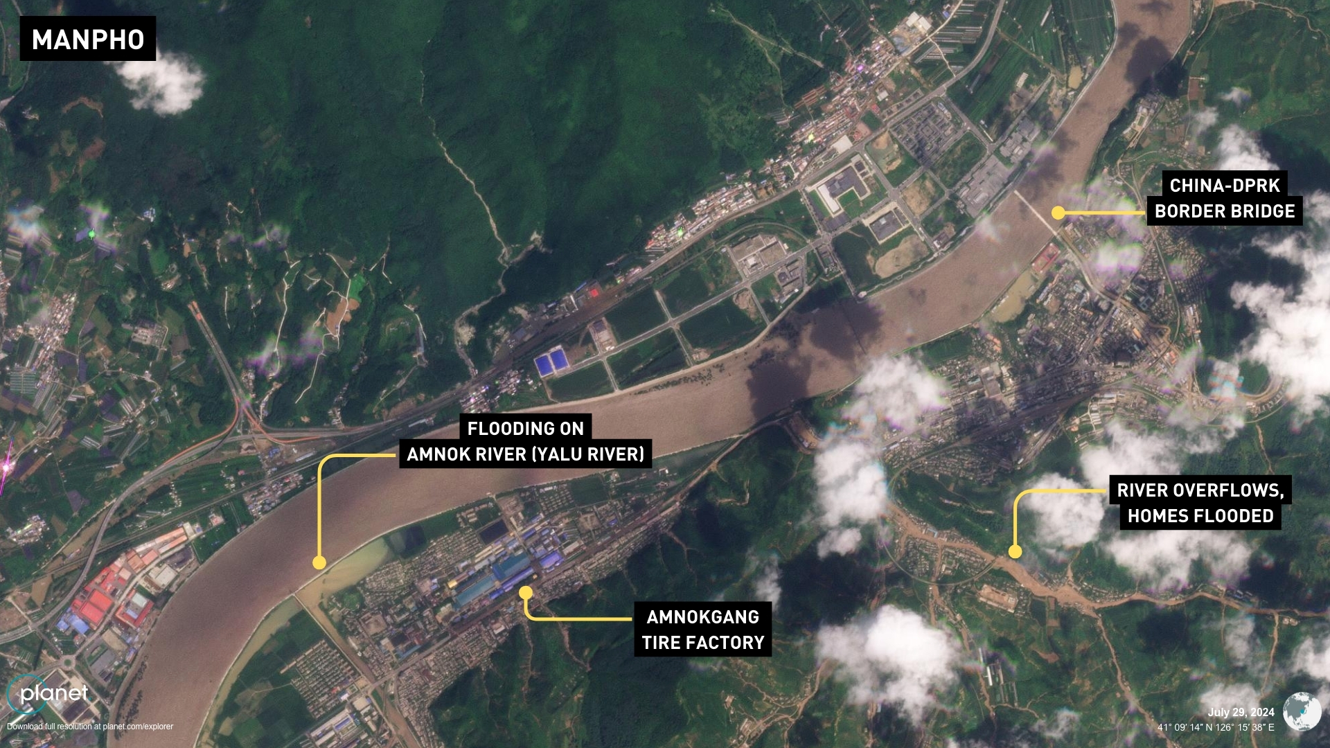
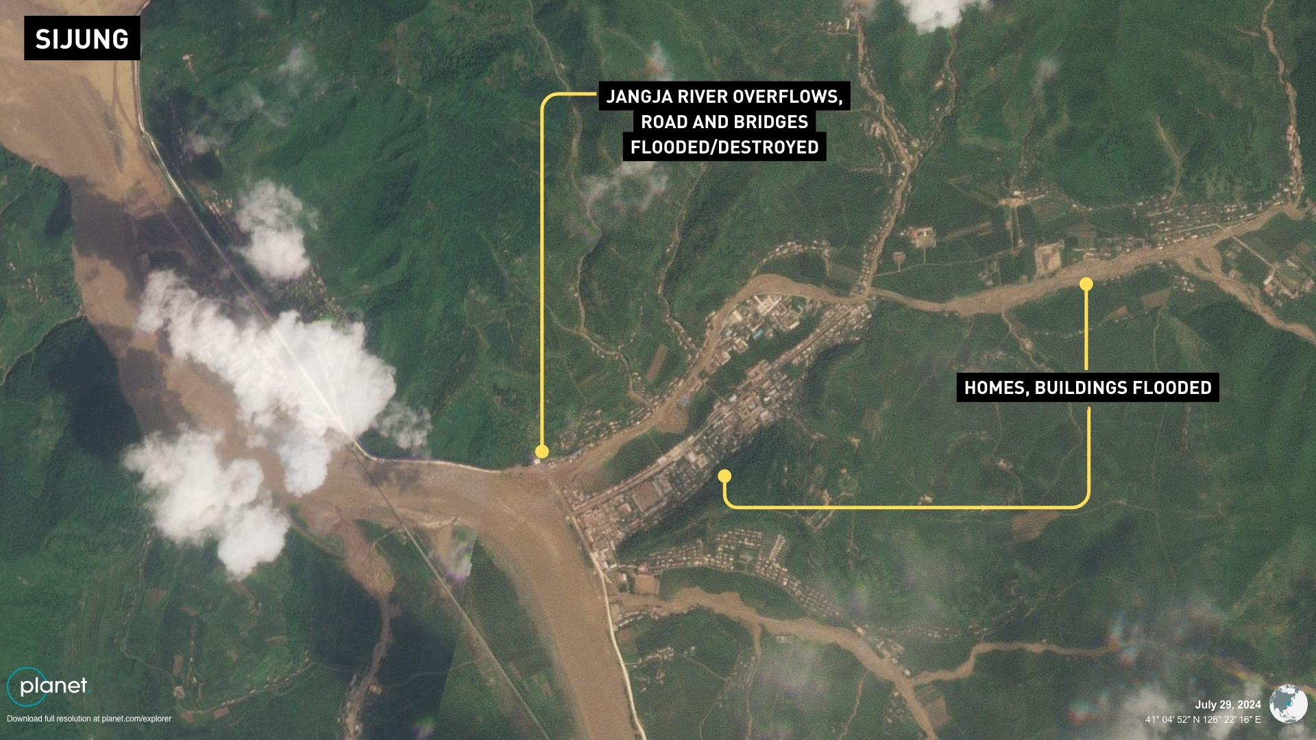
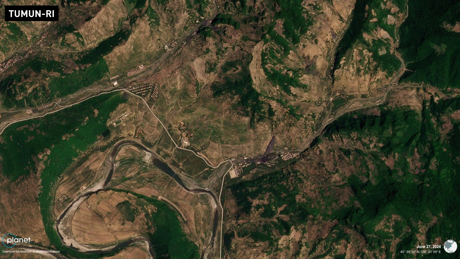
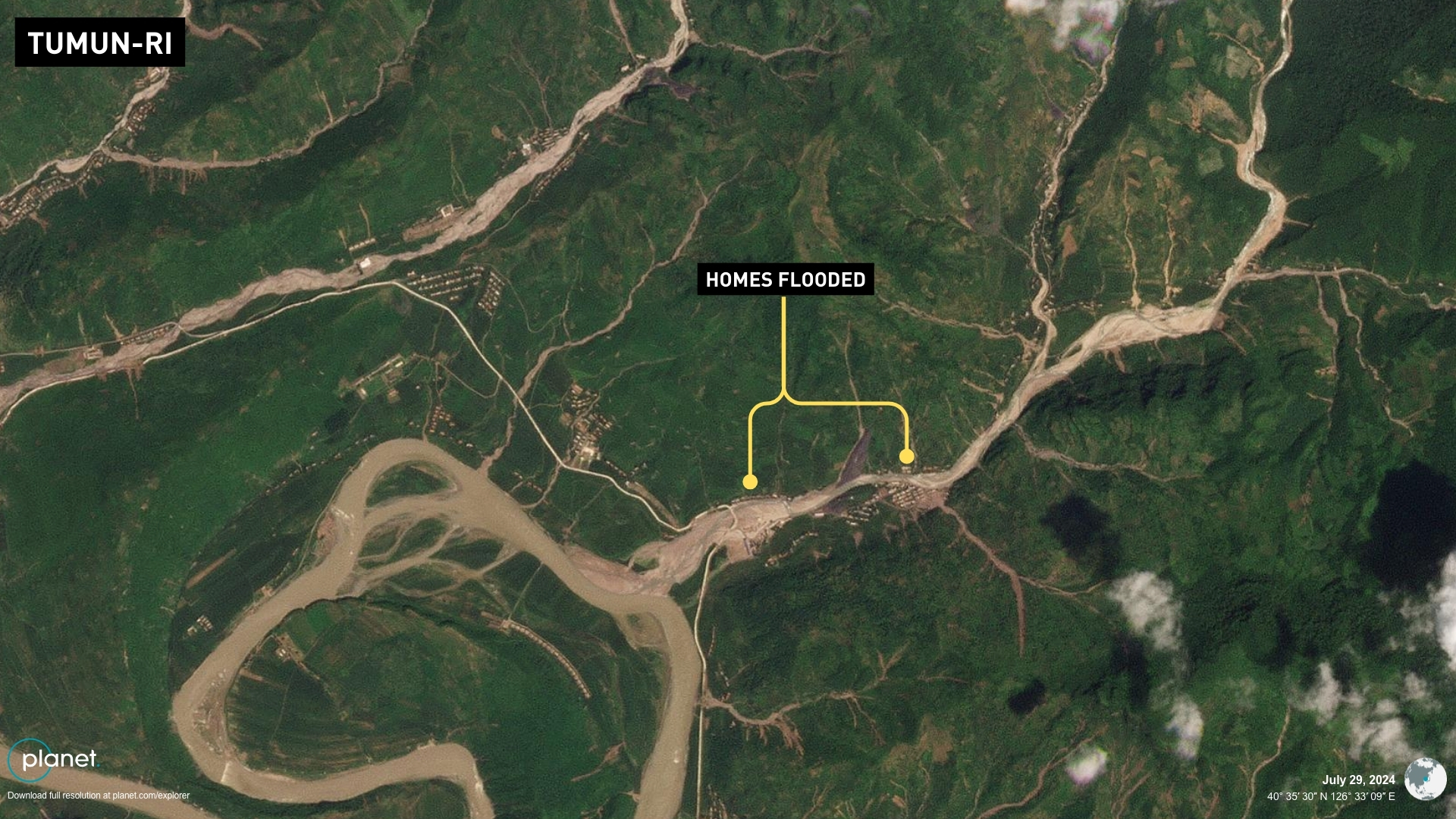
A newly constructed arena and horse track making up Kanggye’s central public park area appeared submerged in water, and the Kanggye Tractor Factory complex that produces missiles may have been affected by surging waters on a tributary running through it. In the border city of Manpho, the Yalu River flooded shores on both the Chinese and North Korean sides, possibly damaging some homes or affecting business at the Amnokgang Tire Factory, where tires for nuclear missile launch vehicles are produced. Sijung County between Manpho and Kanggye also saw severe flooding. More weapons plants in Jonchon County to the south of Songgan, like the February 8 General Machine Factory, could have been affected by flooding along the Jangja River and offshoots there. Dozens more homes appeared flooded in the Tumun-ri area of the county to the east. Residents were possibly left with little warning after state TV failed to forecast heavy rains in the area the previous day and did not air alerts throughout the day on July 27 as it had during and prior to previous storms. Korean Central Television (KCTV) devoted most of its programming on July 28 to the previous day’s celebrations for the Korean War “victory” holiday, showing leader Kim Jong Un happily enjoying a large-scale parade and concert in Pyongyang. 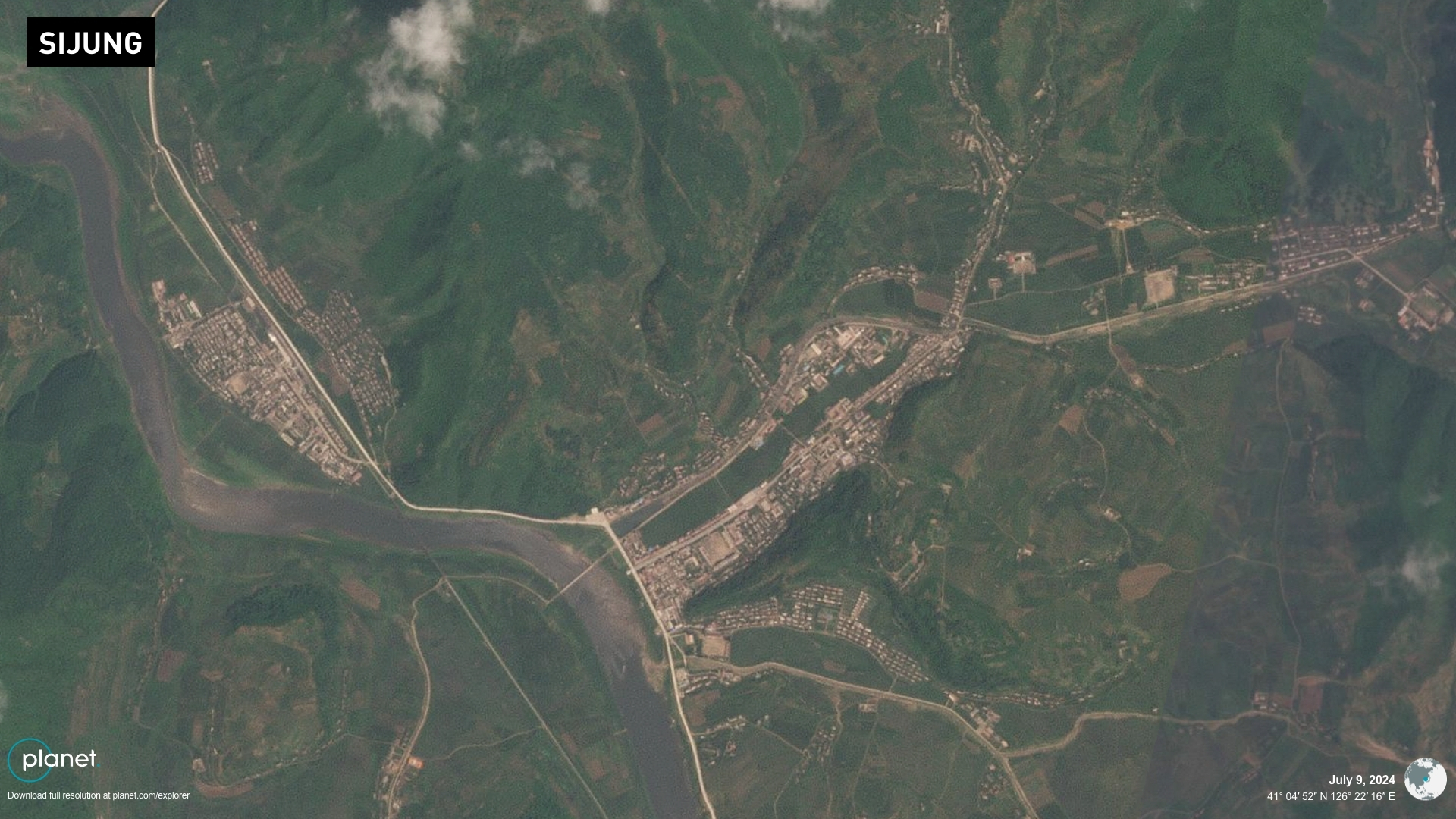
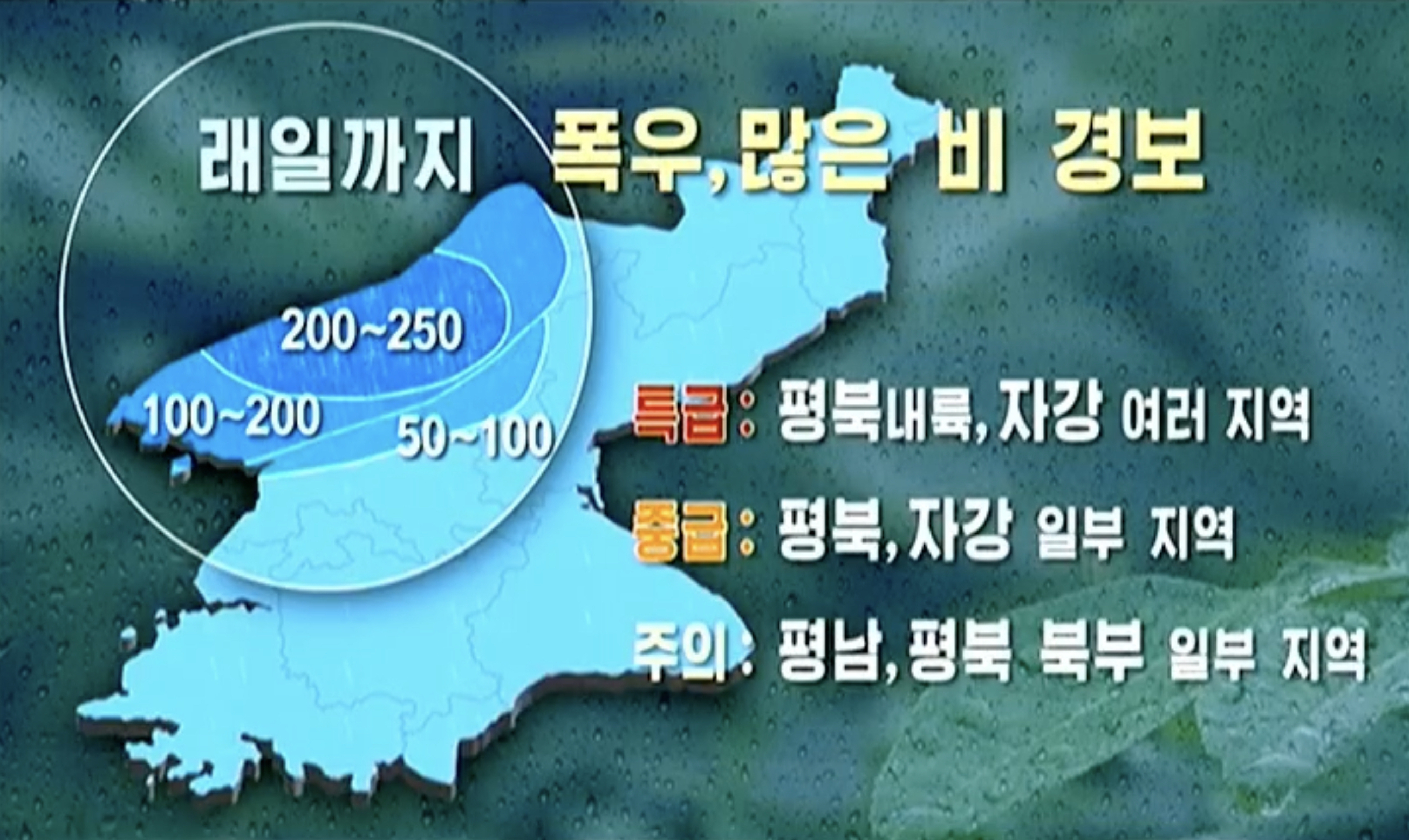
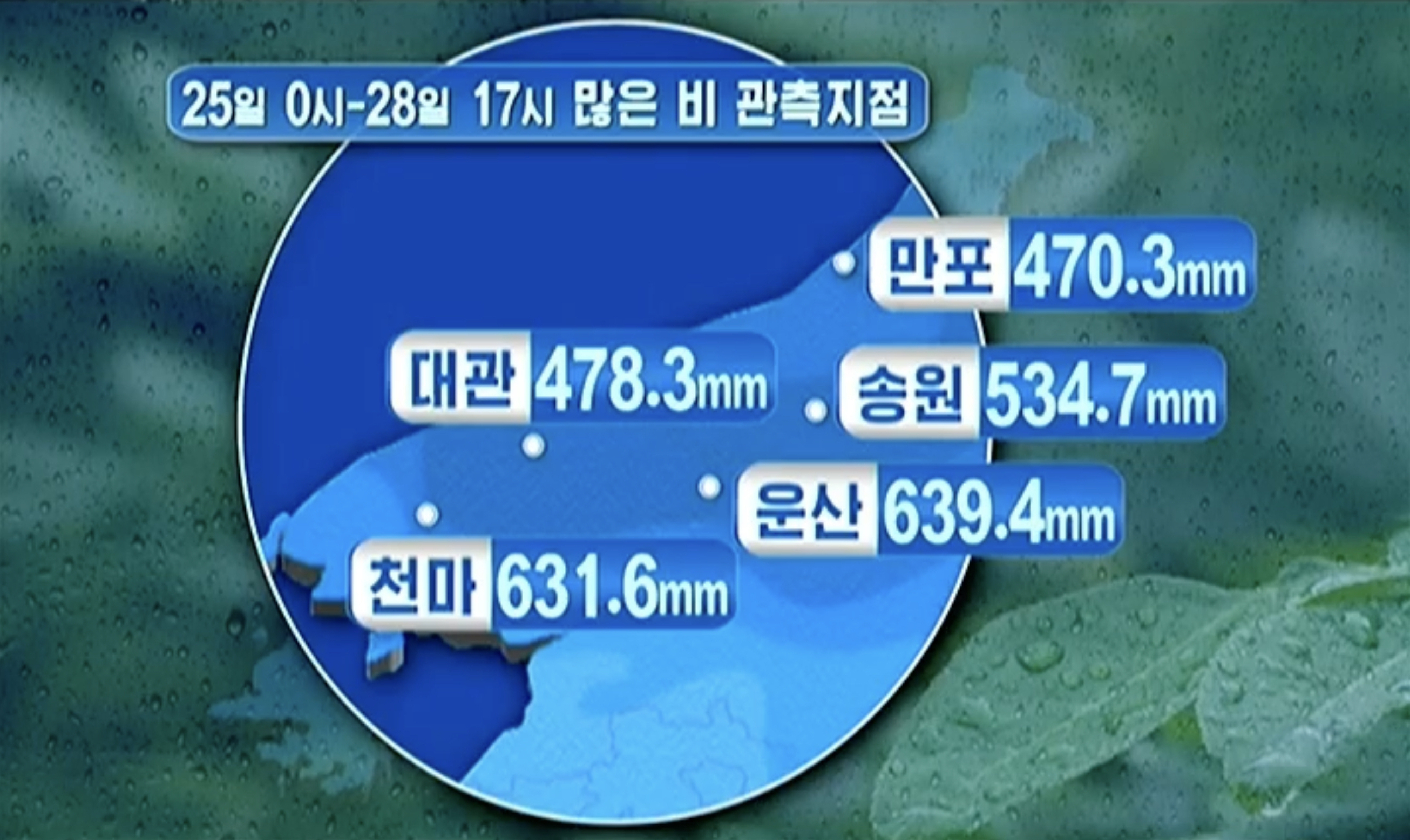
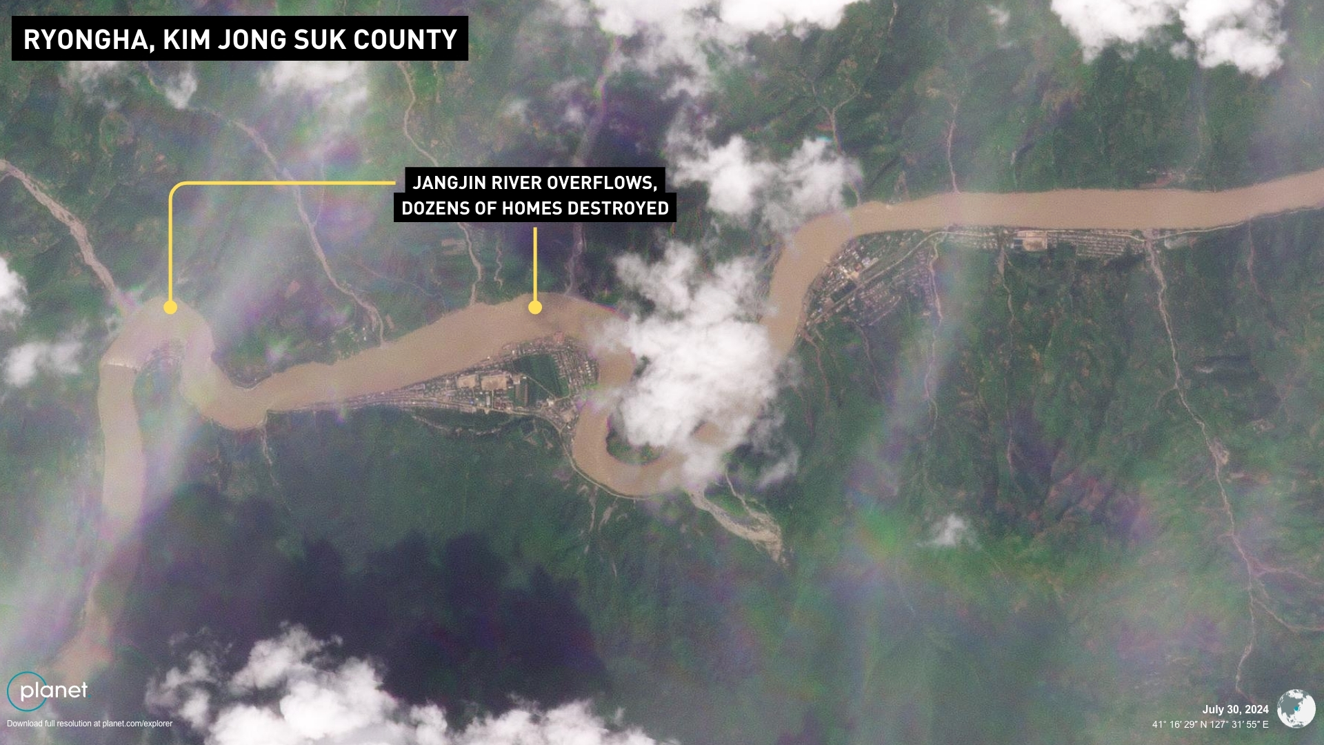
The 8 p.m. news on the day after the flooding briefly stated there was a red-level alert for heavy rain in inner North Phyongan and various parts of Jagang Province, without offering any further details. Kim reportedly fumed at government officials and the state meteorological agency for failing to prepare for the flooding in the first state media reporting on the floods on July 29. He has so far only showed up in one area of North Phyongan Province from July 28 to 30 to inspect the aftermath. RYANGGANG PROVINCE Severe flooding also hit parts of Ryanggang Province, located on the Chinese border to the northeast of Jagang, NK Pro analysis of satellite imagery shows. Water levels appeared high and flooded the banks of the Yalu River running west from the provincial capital Hyesan to Kim Jong Suk County and Kim Hyong Jik County. At least 60 homes appeared completely submerged or wiped away and dozens more flooded in the small town of Ryongha in Kim Jong Suk County. Roads running through the town along the Jangjin River and multiple bridges crossing it were also flooded. 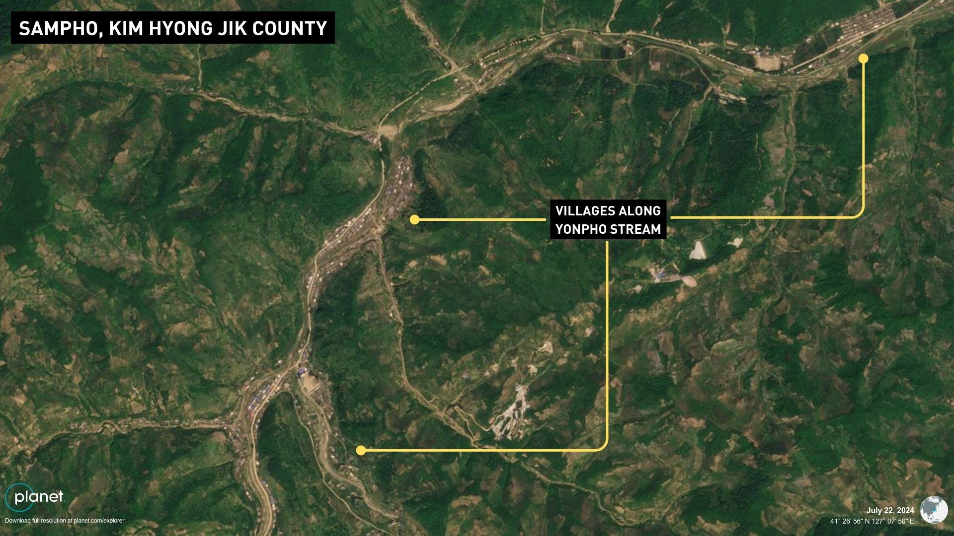
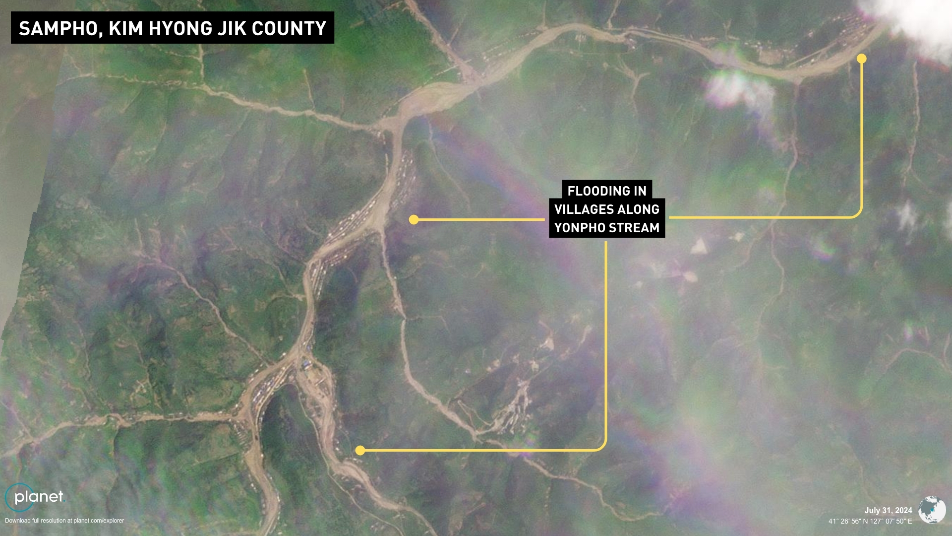
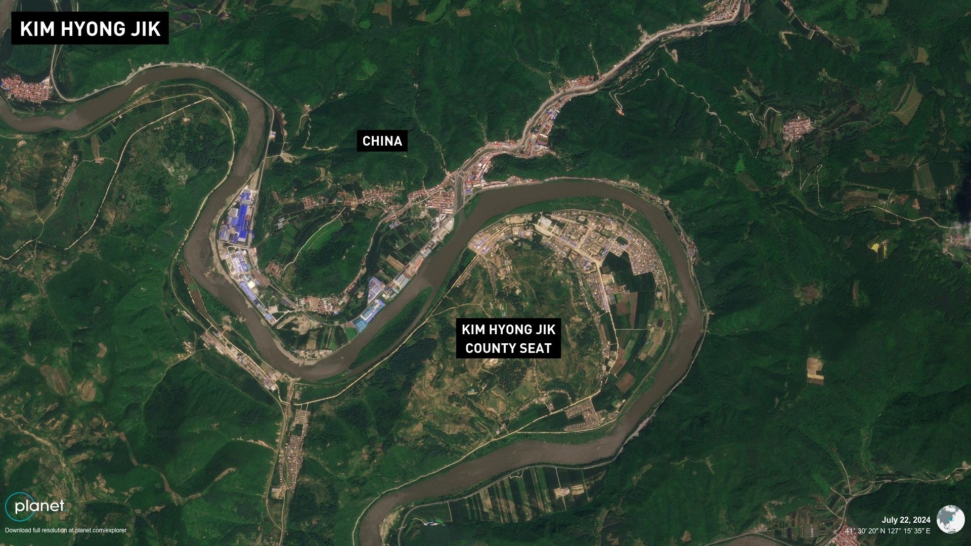
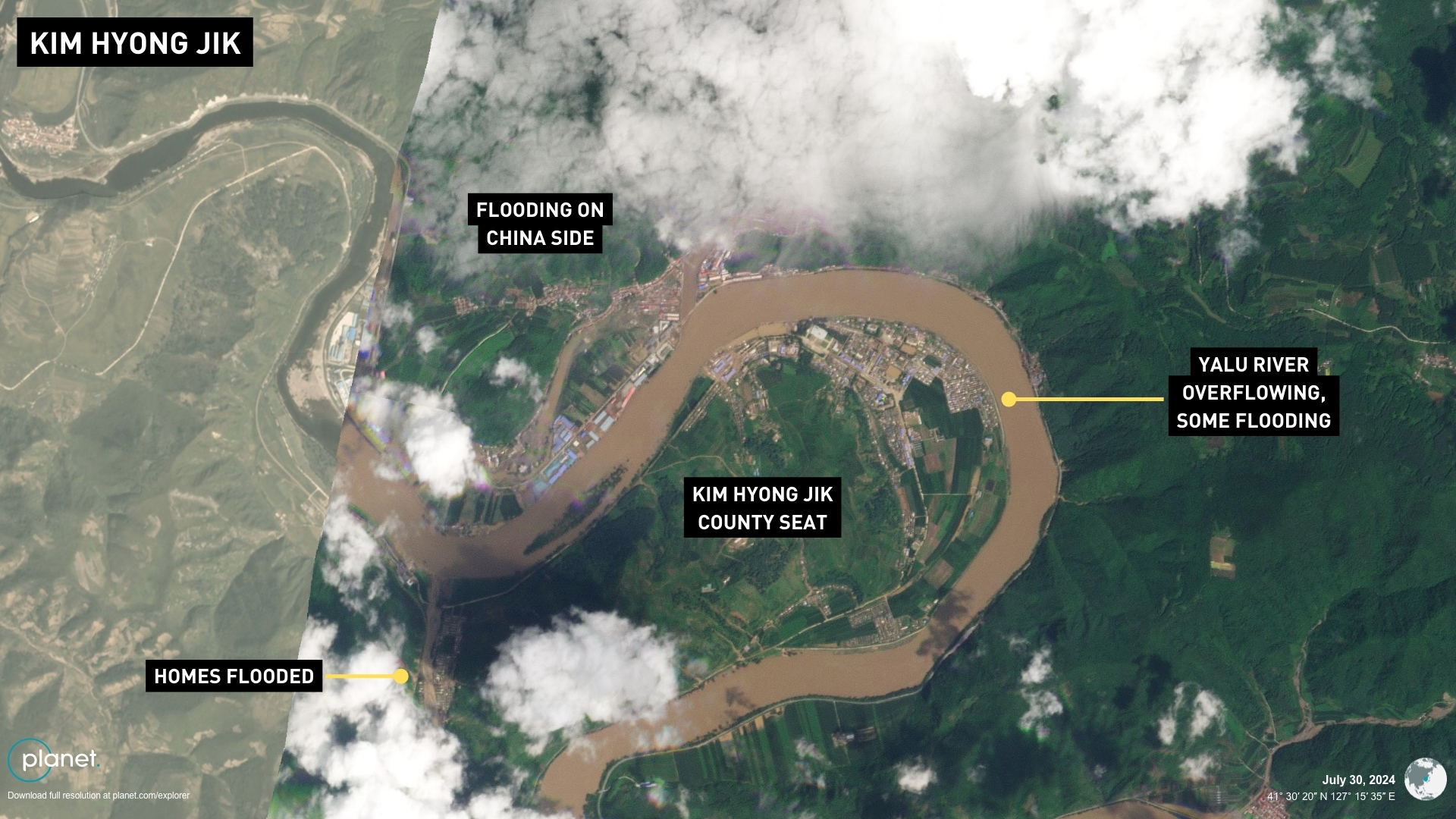
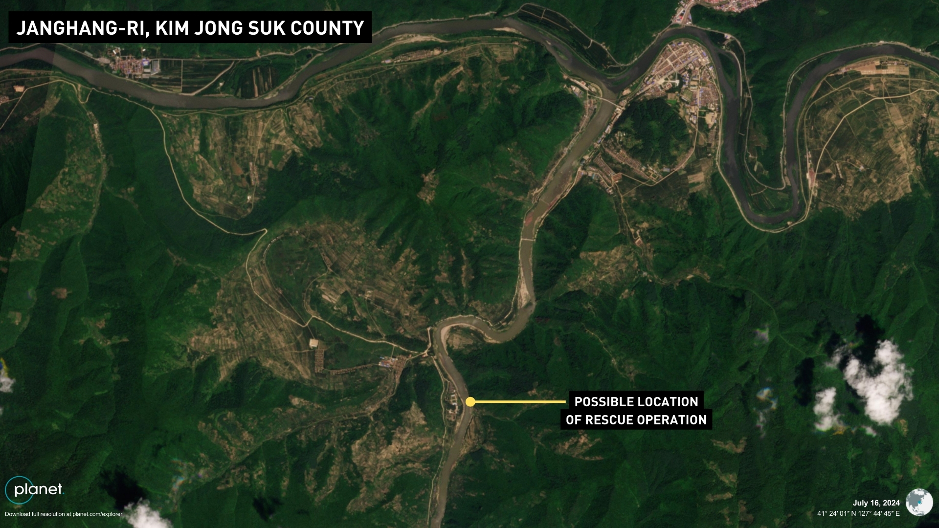
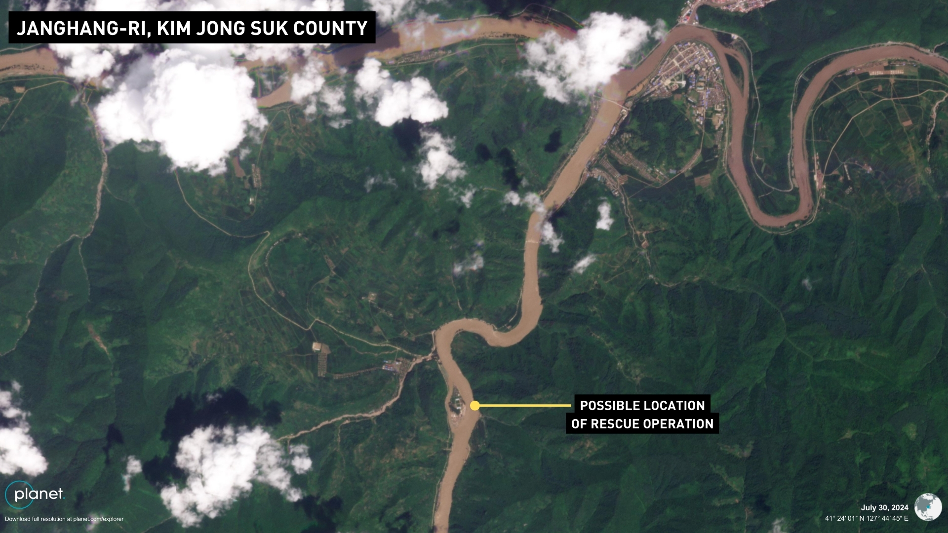
State media reported on July 29 that the military conducted rescue flight operations to the Janghang-ri area of the county on July 27, making seven rounds of helicopter flights to save “more than 150 people” who were stranded by the floods. Satellite imagery shows the Jangjin River overflowed and flooded the town, with a small village of 15 homes and a school left completely isolated in the middle of the river, which may have been where the rescue took place. The location is close to the county seat on the Yalu River and Chinese border. Homes and public buildings along the Yalu River further west in the Kim Hyong Jik County seat appeared flooded, and to the south, dozens more homes and a school were likely destroyed in the Sampho area on the Yonpho Stream. 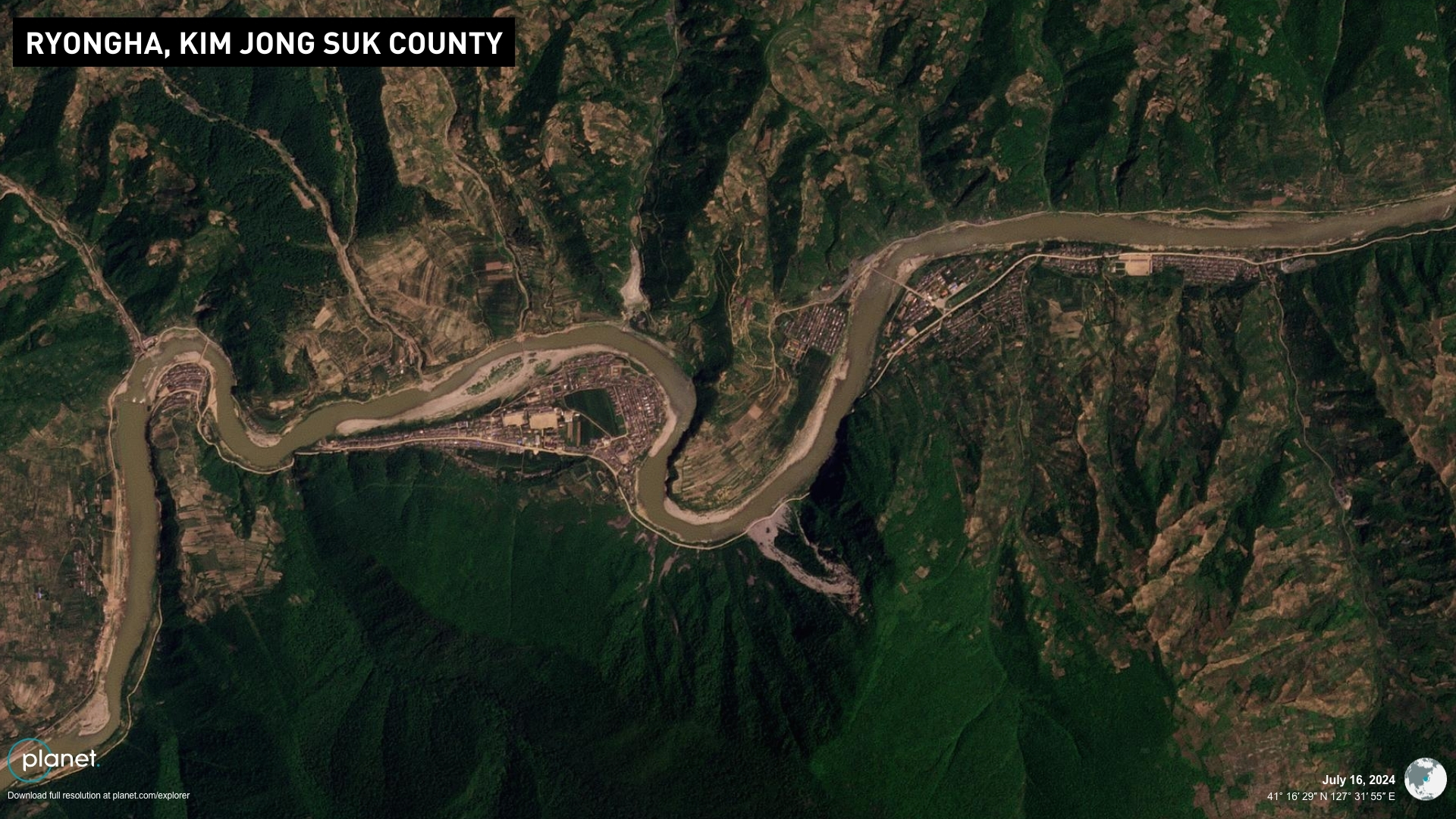
WHAT’S NEXT The true scope of flood damage in Sinuiju and Uiju in the northwest tip of the country is not yet known as the region has remained obscured by cloud cover in satellite imagery taken in recent days. But the flooding there is likely to severely disrupt commerce nationwide as it is the second largest trade port in the country, and shipments from a weapons factory likely now supplying Russia could also be affected. 38 North reported that rail and road links have been cut to an airport complex that has been used to process all local imports since the pandemic. North Korea experienced similar levels of severe flood devastation in Aug. 2021 and Sept. 2020 in the northeast of the country. Kim Jong Un mobilized special resources for Sinhung near Hamhung on the east coast in 2021, likely due to its important factories producing armored military vehicles and missile launchers, suggesting he may do the same for Jagang Province after visiting multiple times in the last year to inspect arms production. Edited by Bryan Betts © Korea Risk Group. All rights reserved. |

October 26, 2026Oct 26, 2026

The ultimate resources for professionals working on North Korea
 SHARE
SHARE COPY LINK
 X
X MASTODON