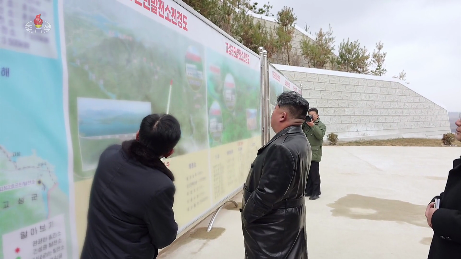
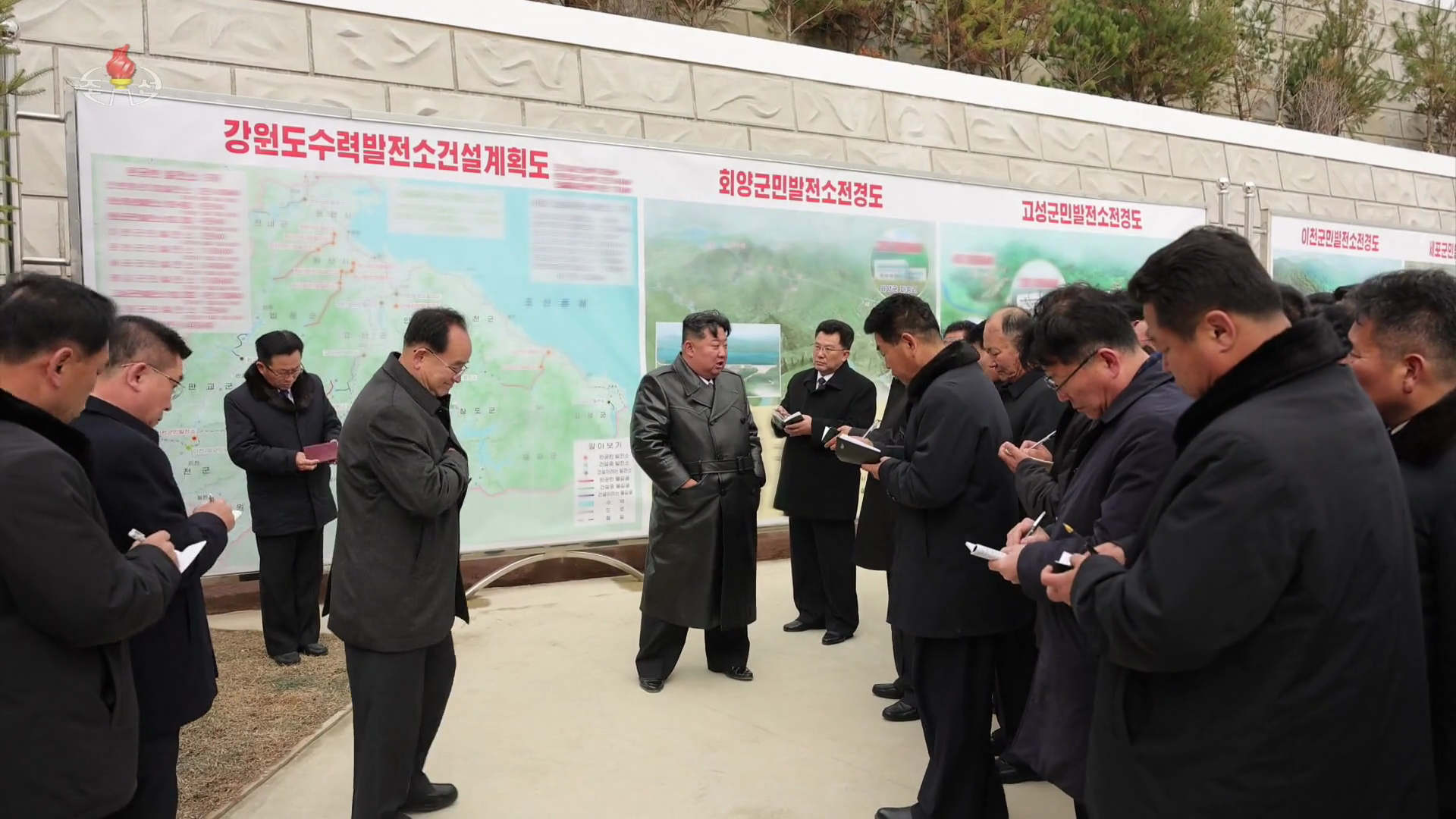
  Investigations North Korea plans to flood DMZ for new power station near KumgangState media reveals map of planned dam construction that will create reservoir running up against MDL  North Korea is planning to build a dam to create a reservoir inside the Demilitarized Zone (DMZ) near the Mount Kumgang tourist zone, according to NK Pro analysis. The revelation came in a Korean Central Television (KCTV) segment that aired on Nov. 21 showing leader Kim Jong Un inspecting the newly built Pongpho Dam in Kangwon Province, part of the Hoeyang Army-People Power Station. NK Pro identified an illustration on a map Kim inspected of a reservoir alongside the Military Demarcation Line (MDL) bifurcating the DMZ. A label on the map describes it as the “Kosong Army-People Power Station No. 2” (고성2호군민발전소), with a yellow mark indicating it was a “power station to be constructed” (건설하려는 발전소). The map further suggests the dam and power station will be built near Wolbisan-ri around a large meander in the Nam River, creating a reservoir that will raise water levels up the river stretching around six miles (10 km) to the south. 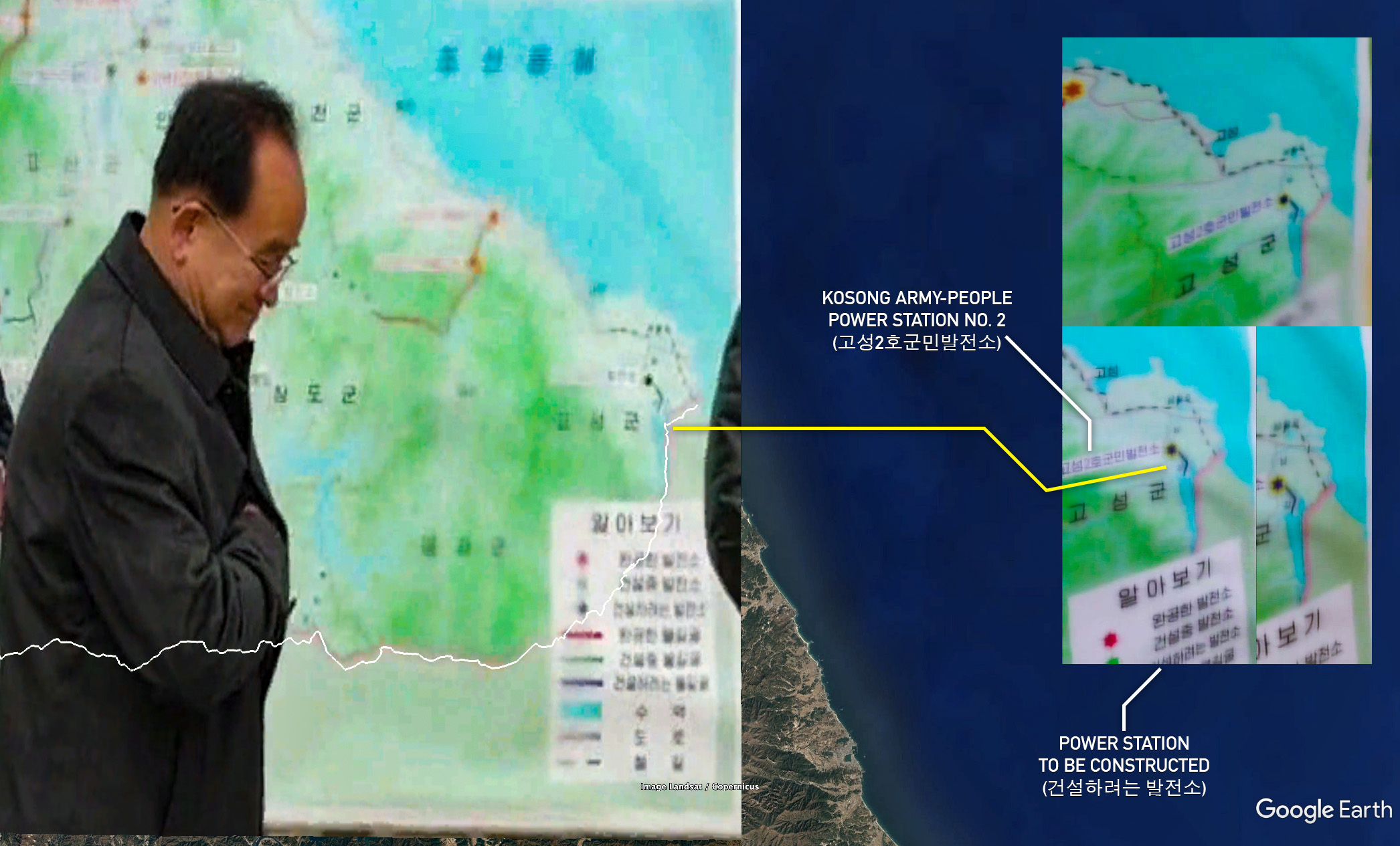
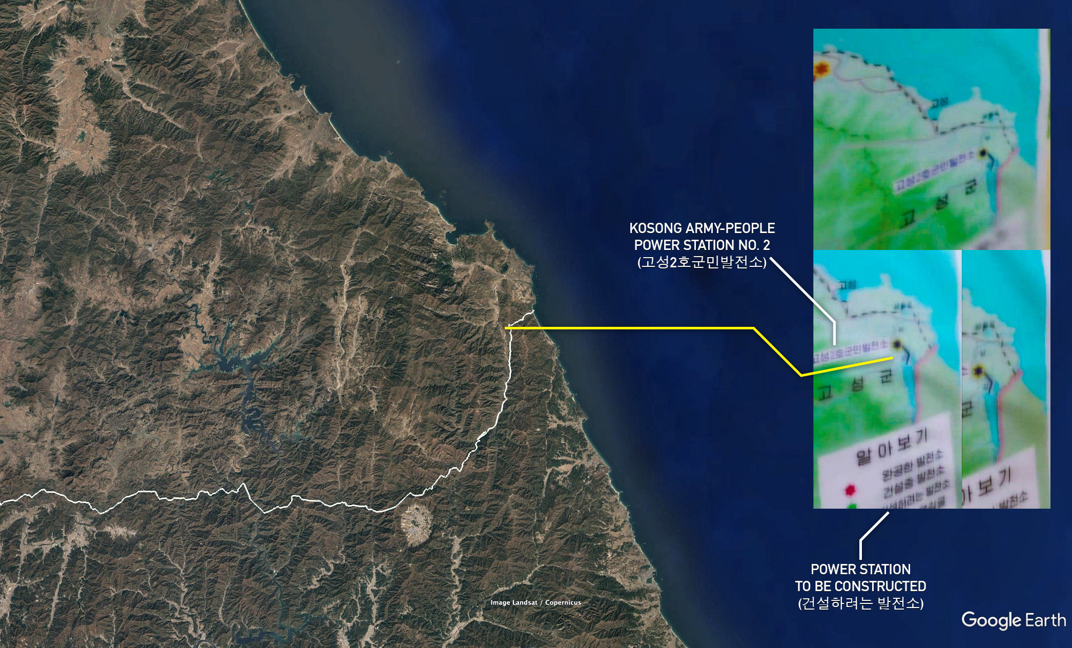
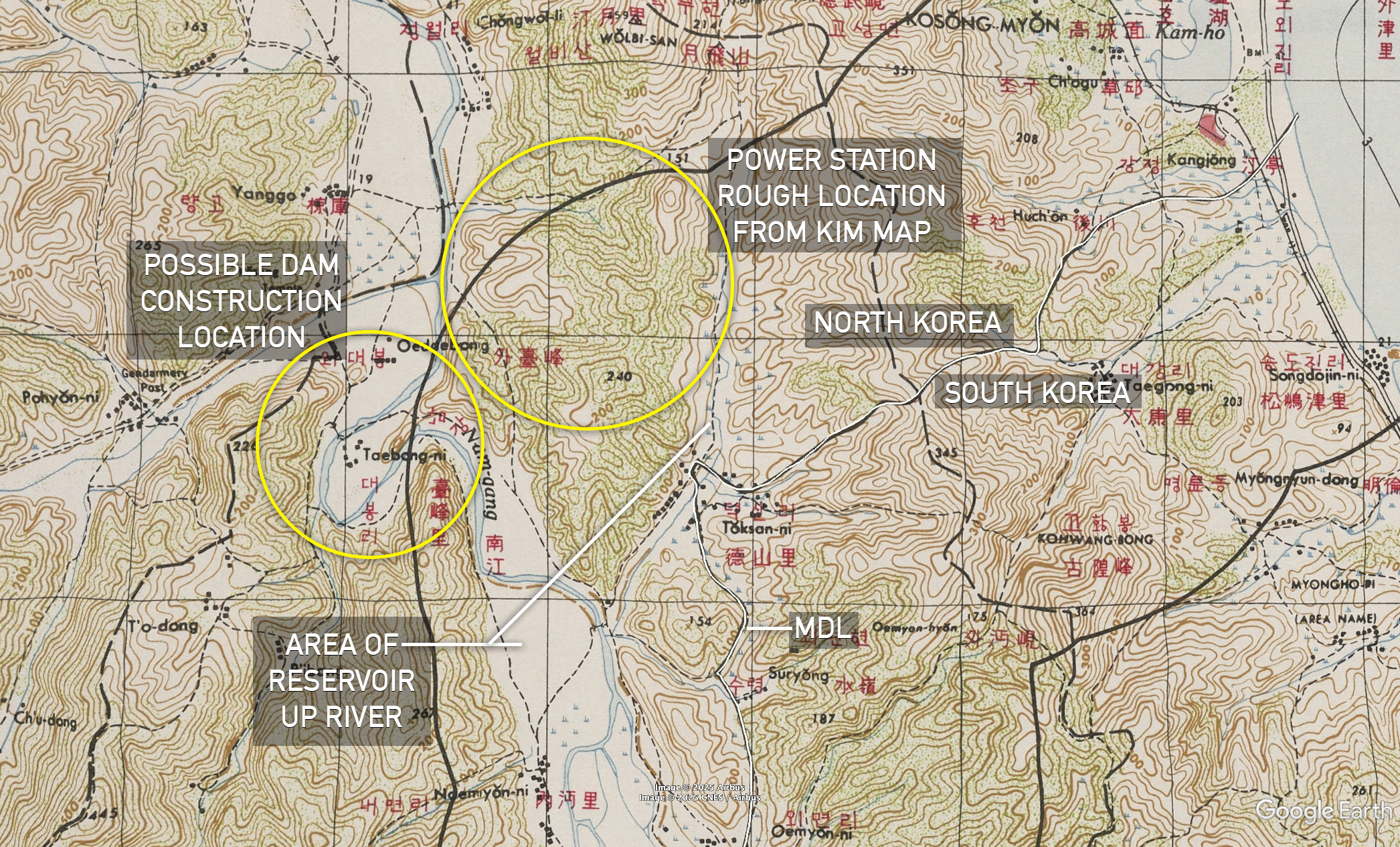
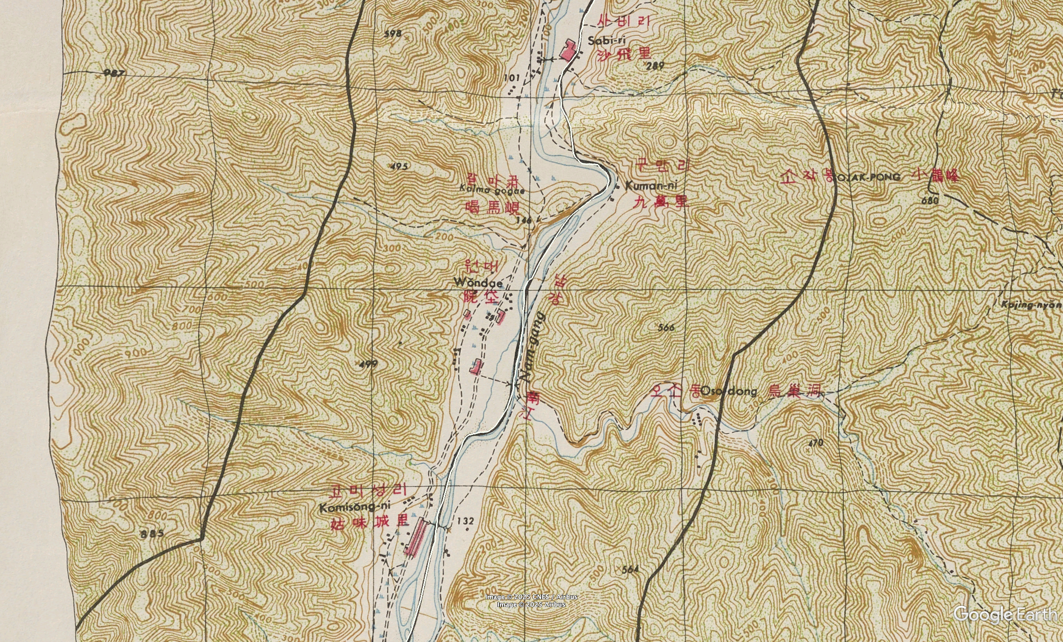
The reservoir will likely stay in North Korean territory inside the DMZ if river levels do not rise further south, according to NK Pro analysis based on the MDL’s path, as drawn on maps from the 1953 Armistice Agreement. The map displayed at the Pongpho Dam inspection cuts off at the southern end around Sabi-ri (사비리), showing the reservoir tapering off to the north on the Nam River. The MDL was drawn along the treeline to the east of the Nam’s riverbed in the Armistice Agreement map (page 15), until just south of Sagi-jom (사기점), giving the entire riverbed to North Korea in those parts. The official border begins to divide the river between both Koreas around Sabi-ri. This allows for the possibility that water levels may rise to cover South Korean territory in the valley along the river at the southern end of the reservoir, which may become a point of contention for the South Korean military if the project comes to fruition. 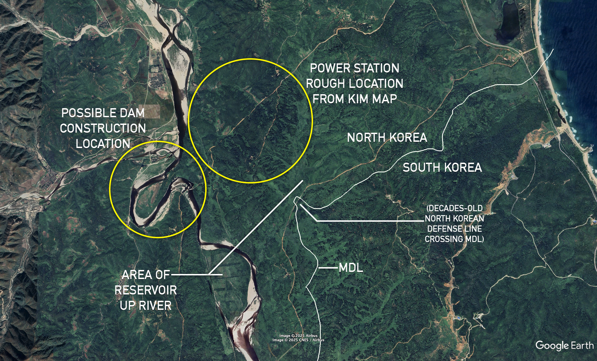
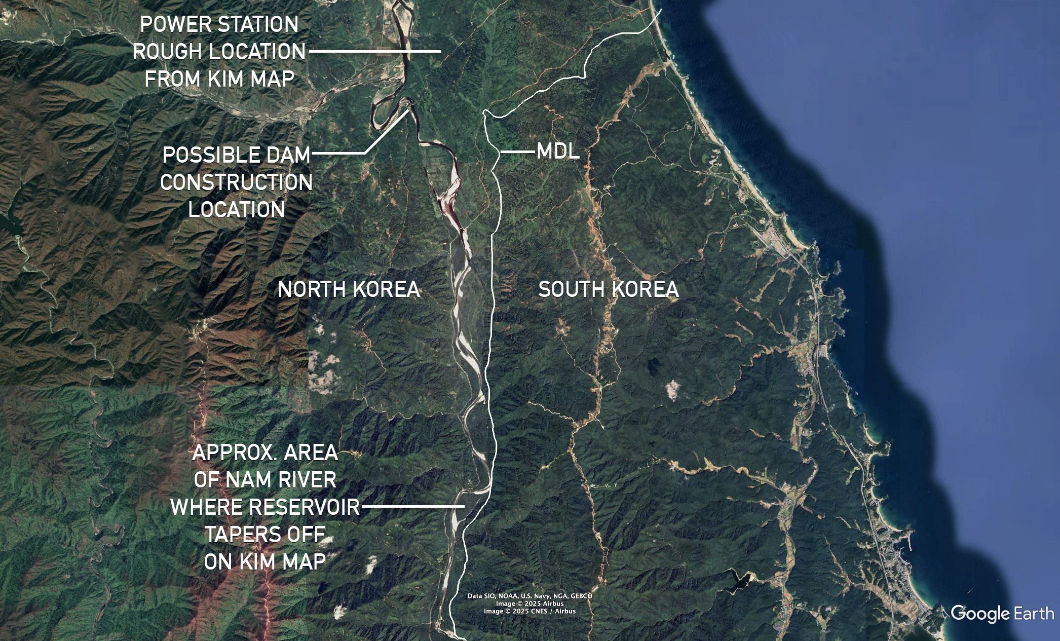
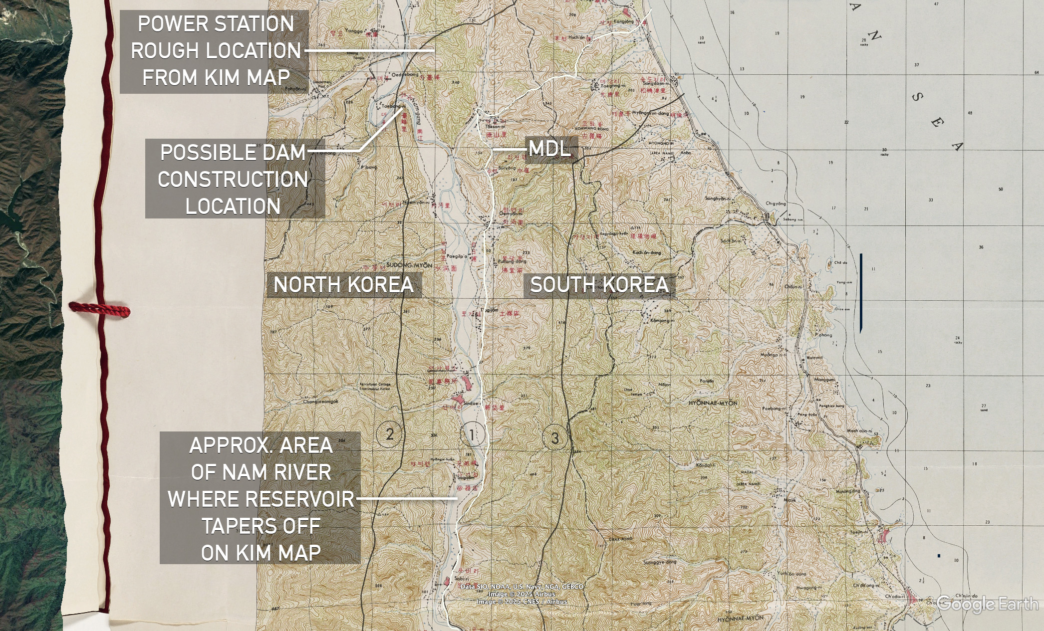
State media has not previously reported on this project, though Kim reportedly gave instructions during his inspection last week on “building [additional] hydropower stations and strengthening the independent economic foundations of the province.” NK Pro analysis of Planet Labs satellite imagery finds no major signs of dam construction in the area indicated on North Korea’s map. However, minor digging and construction took place at the river meander between June to August this year, possibly in relation to the project. The reservoir’s shores will reach the MDL at the base of the mountains in South Korea’s Goseong County, which is heavily patrolled by ROK troops in the DMZ. North Korea has refortified most of its southern border in the DMZ in the last two years with new forward defense lines, though not yet at a large gap along the MDL in the area of the planned reservoir, possibly due to the power station plans. Some have been built near the planned dam site in recent months, however. Edited by David Choi © Korea Risk Group. All rights reserved. |

October 16, 2026Oct 16, 2026

The ultimate resources for professionals working on North Korea
 SHARE
SHARE COPY LINK
 X
X MASTODON