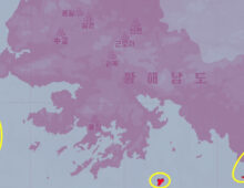
  Investigations North Korea building football field-sized blockade at destroyed border roadMove appears aimed at reinforcing ‘permanent’ severing of connections to South, in line with Kim Jong Un’s orders 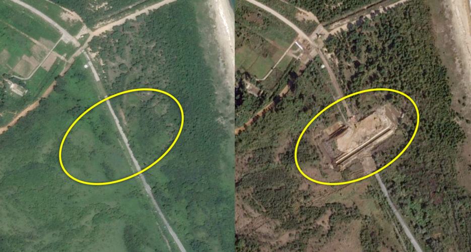 North Korea is building a huge blockade over a now-destroyed road on the inter-Korean border that is larger than a football field, according to NK Pro analysis of satellite imagery, apparently doubling down on its push to sever connections to the South. The construction has taken place over the last week at the east coast border road, just feet from the Military Demarcation Line (MDL) that bisects the demilitarized zone (DMZ) separating the Mount Kumgang resort area in the North and Goseong in the South, Planet Labs high-resolution imagery shows. The work appears to be part of efforts to “completely cut off” transportation links with South Korea, as leader Kim Jong Un demanded in January, to a point where they cannot be easily restored. It also comes as Kim has sought to send a message that he is not leaving space for future reconciliation with the South amid his campaign to solidify the ROK’s status as a “hostile” enemy state in the DPRK’s constitution. North Korea’s military said in a statement last week that it had detonated and dug up 200-foot (60-meter) sections of parallel road and rail lines at east (Donghae) and west (Gyeongui Line) inter-Korean connection points on Oct. 15. The statement added that the military will “continue to take measures to permanently fortify the closed southern border.” 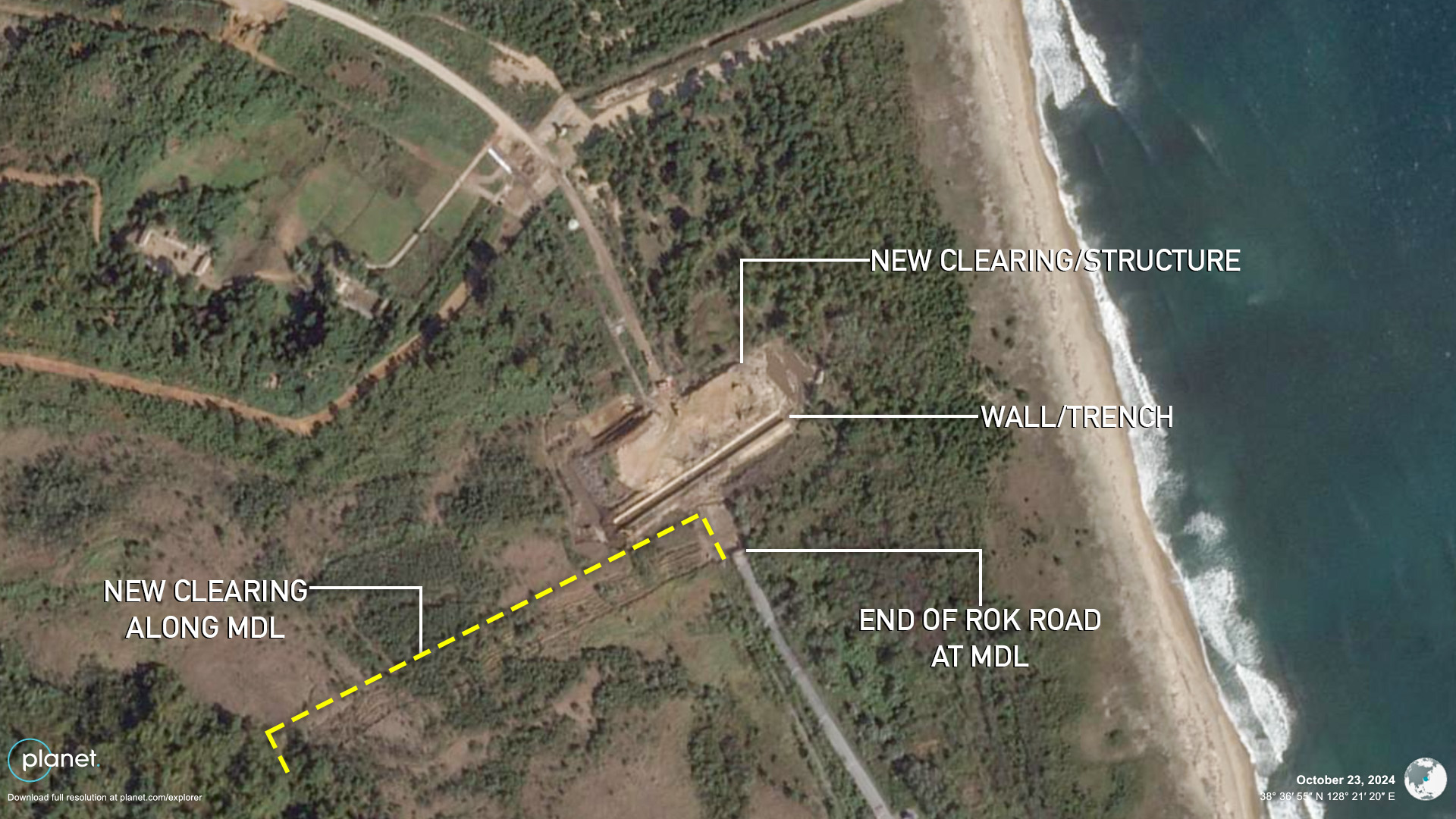
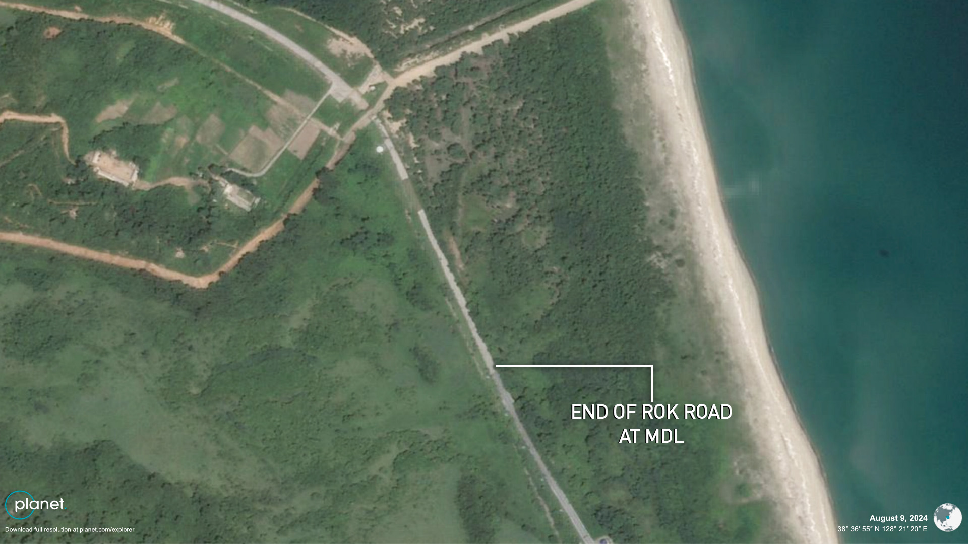
Between Oct. 15 and 23, a rectangular area of cleared land measuring around 230 by 575 feet (70 by 175 meters) appeared just 165 feet (50 meters) from the MDL, according to Planet Labs high-resolution imagery. Along the southern end of the area cutting across the road closest to the MDL is a wall and 16-foot wide (5 meter) trench. Photos taken by NK Pro from an observatory on the South Korean side on Thursday show a bulldozer active on the new blockade site with taller mounds of dirt behind it. It’s not yet clear if a tall structure or other type of blockade will fill the entire three-acre (1.2 ha) cleared area.  Additionally, the imagery shows that the North is building a new defense line along and close to the MDL stretching around 985 feet (300 meters) to the west of the road and 85 feet wide (25 meters). High-resolution Planet Labs imagery of the now-demolished Gyeongui Line inter-Korean road and rail connections in the west also showed efforts were underway by Oct. 17 to carve out a large area of land. The cleared area on the MDL had expanded to around 460 by 375 feet (140 by 115 meters) by Oct. 20, medium-resolution imagery shows. 

Meanwhile North Korea has also constructed new forward defense lines and blockades right along and sometimes crossing the MDL in other locations since earlier this year. Since the 1953 Korean War Armistice, the two Koreas have typically maintained such lines along each side’s DMZ boundary line and further inside the DMZ, but not on the central MDL. Ifang Bremer contributed reporting to this article. Edited by Alannah Hill © Korea Risk Group. All rights reserved. |

October 11, 2026Oct 11, 2026

The ultimate resources for professionals working on North Korea
 SHARE
SHARE COPY LINK
 X
X MASTODON