
  Analysis Heatmaps for 2018 show North Korean vessels’ disappearing footprint at seaBut ships registered in Togo, Sierra Leone, Belize and Palau could be picking up the slack 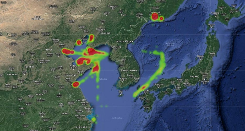 A heatmap generated using location information from North Korea’s fleet of ships appears to confirm the diminishing presence of the DPRK’s fleet in foreign ports. Data collected by the NK Pro ship tracker throughout 2018 highlights an apparently continuing trend, where ships flying the North’s colors are seen less frequently and fewer locations in the region. Whereas data collected over the course of five years shows how North Korea’s fleet once crossed the Pacific headed for Latin America or called in on ports around Africa and the Middle East, last year’s © Korea Risk Group. All rights reserved. 
|
April 26, 2024
The ultimate resources for professionals working on North Korea