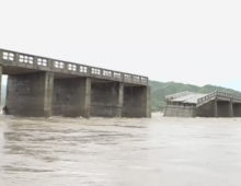
  Investigations Flooding wipes out North Korean villages at key military base near borderSatellite imagery reveals government recovery efforts at reported artillery HQ, despite silence in state media  A large North Korean military base close to the South Korean border suffered devastating floods in late July, according to NK Pro analysis of satellite imagery, wiping out hundreds of homes after a dam appeared to break. Planet Labs imagery shows at least 380 duplex-style single-story homes were completely washed away by flooding. The homes surrounded the base in central Singye County of North Hwanghae Province and along the river leading up to a busted dam to the east. The floods have likely displaced thousands of residents and caused operational disruptions to what is reportedly a key administrative center for artillery units aimed at South Korea. Imagery also shows severe flooding and landslides to the east in Ichon and Phangyo counties, destroying roads and bridges and damaging homes and public buildings in late July. SECRET CRISIS AT MILITARY BASE Weather reports in state media suggest the flooding occurred between July 20 and 23, days before leader Kim Jong Un hosted large-scale celebrations in the capital to mark the end of the Korean War. It appears the major damage in Singye was caused by a flash flood event, suggesting there may have been little warning for residents in its path, likely causing deaths and injuries. Satellite imagery shows signs of a massive flow of water coming down from the broken Wangdang No. 2 Reservoir, hundreds of meters wider in some places than the river on a typical day. 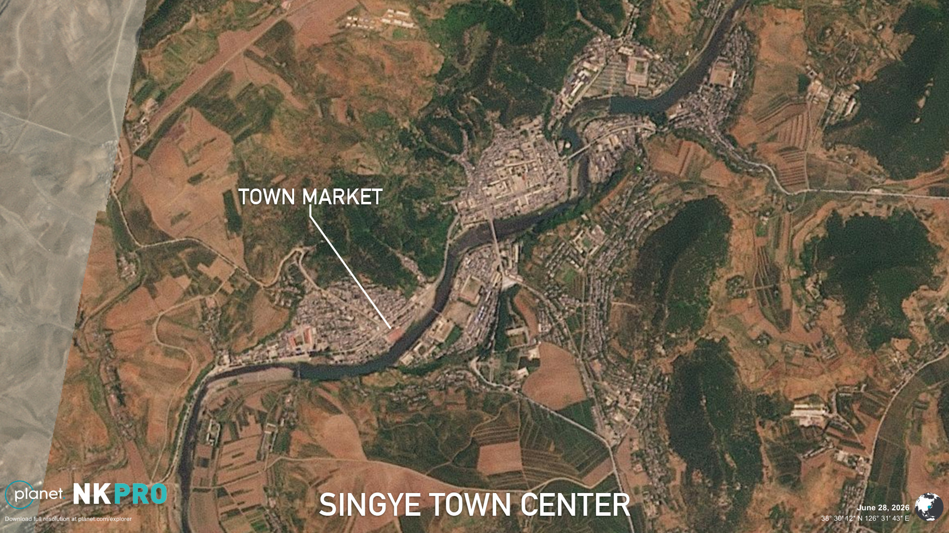
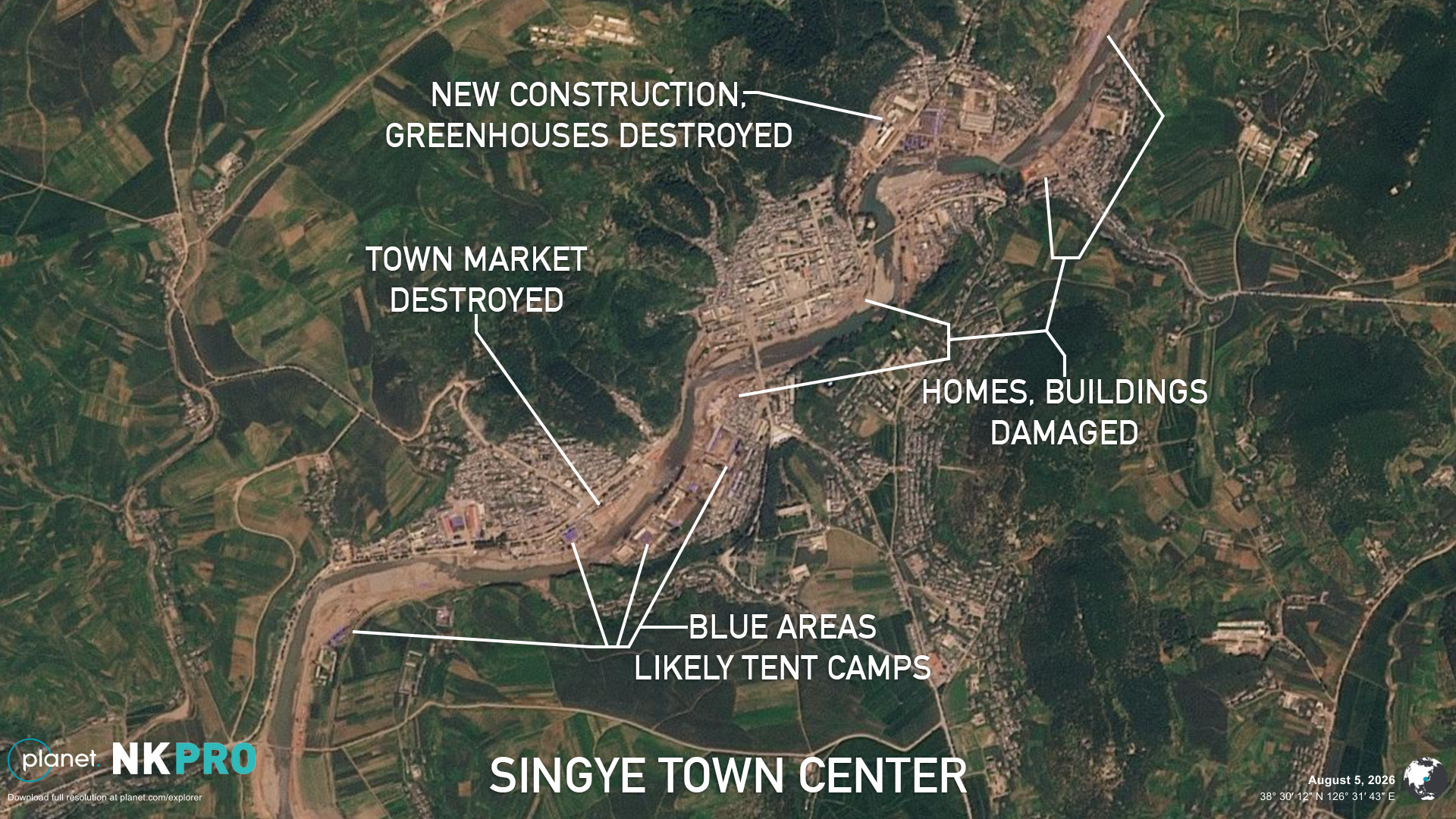
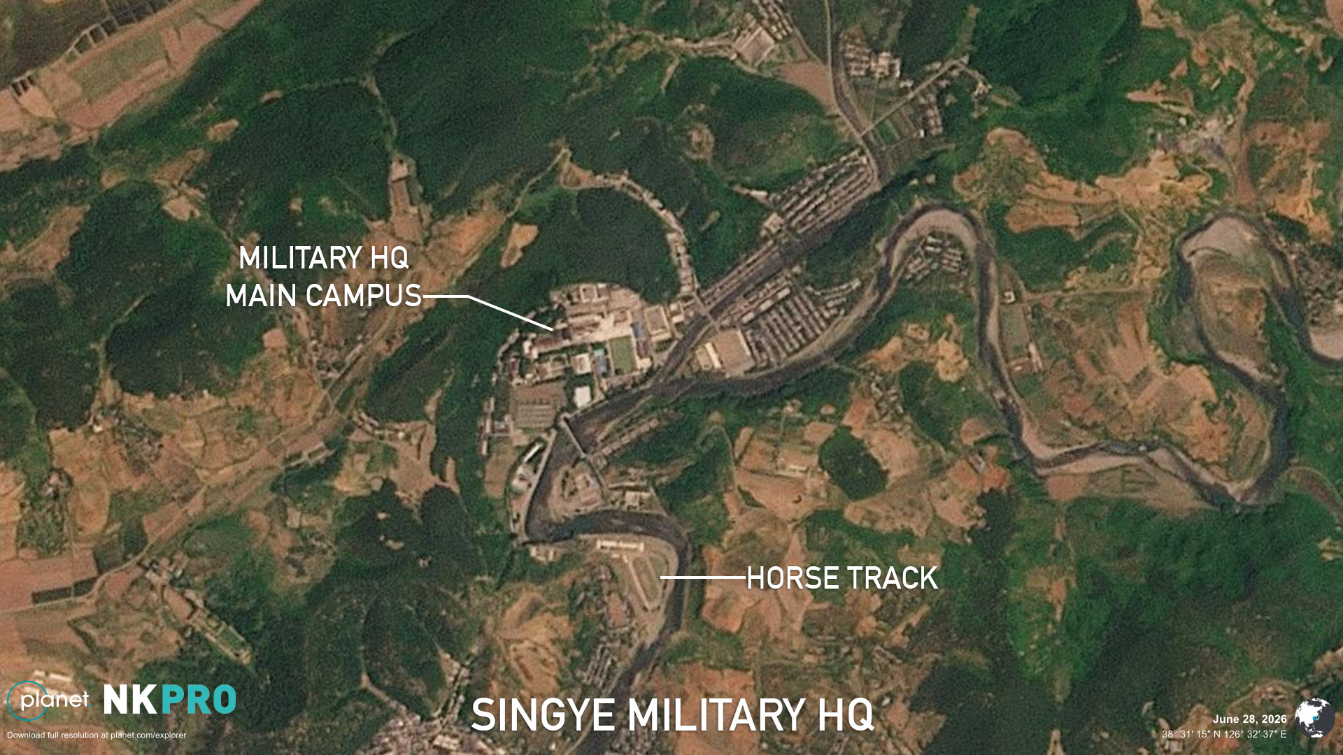
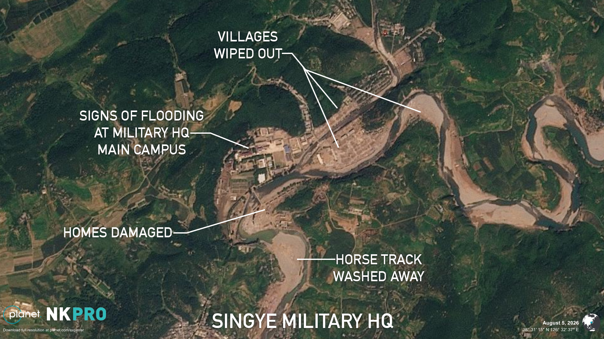
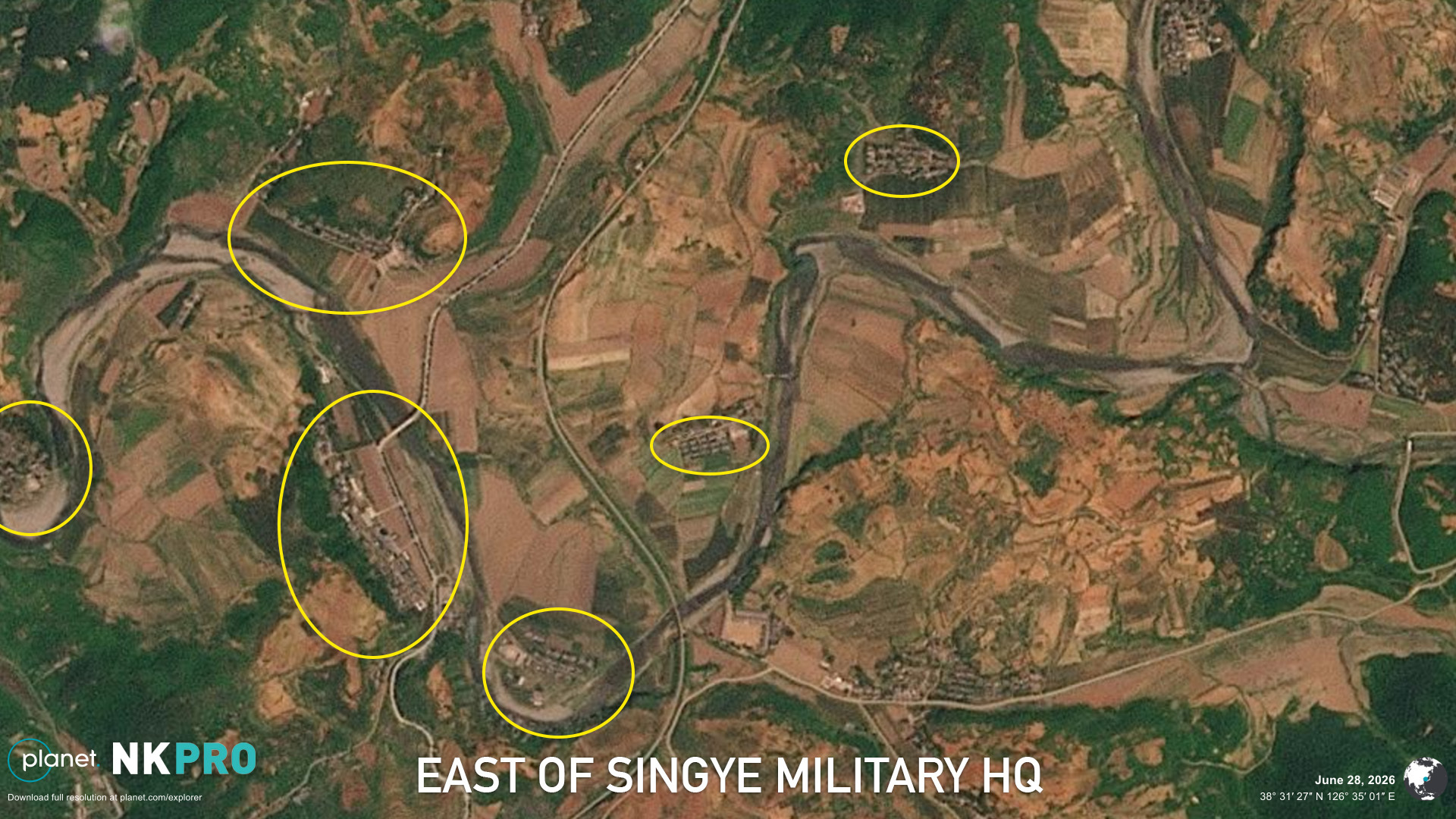
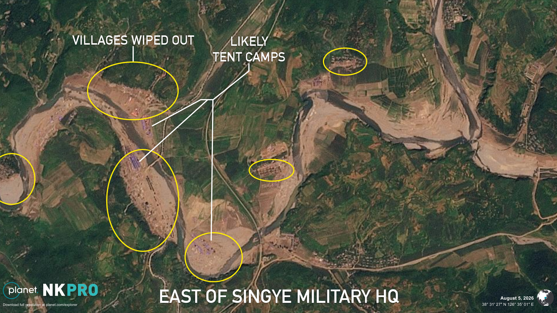
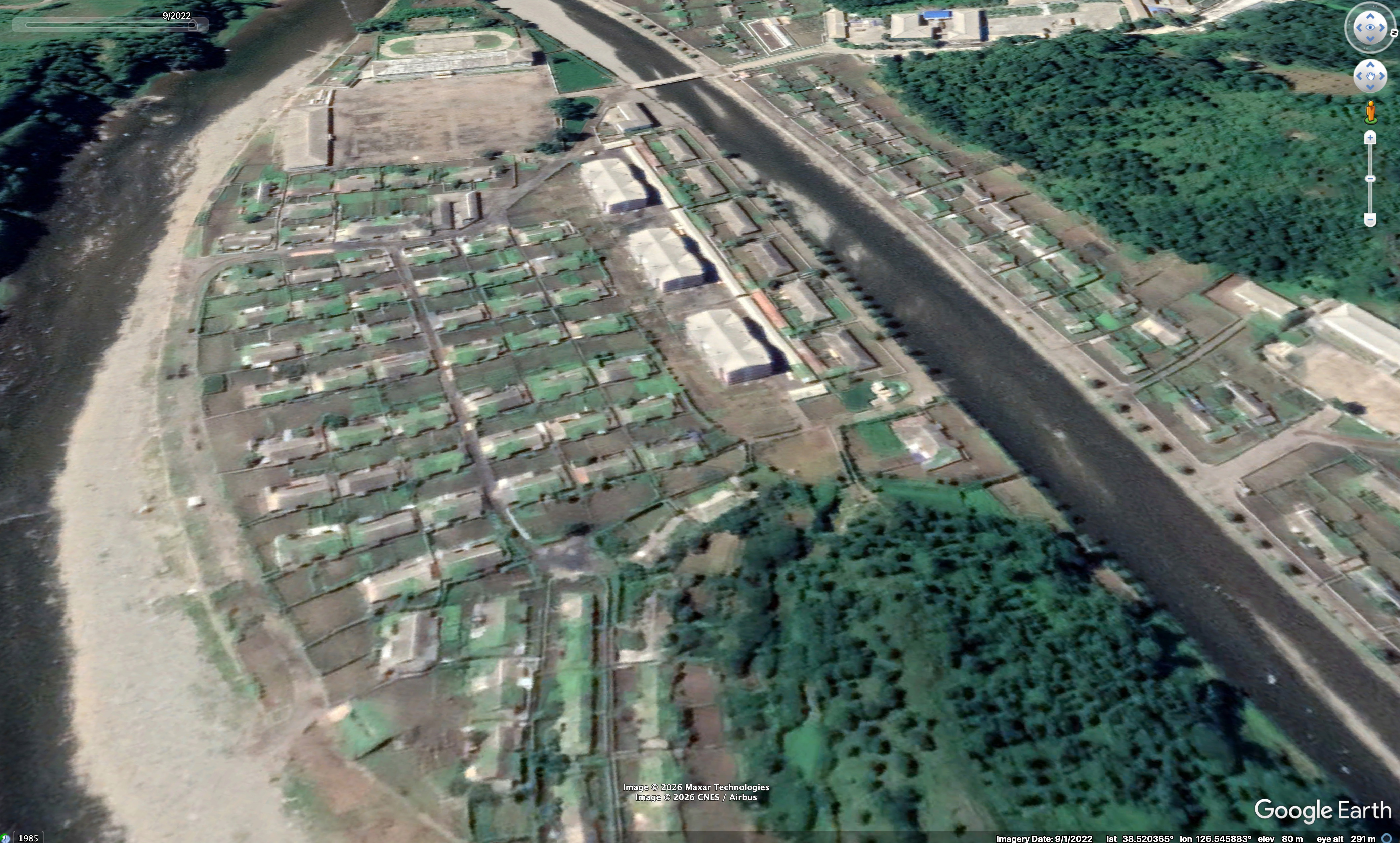
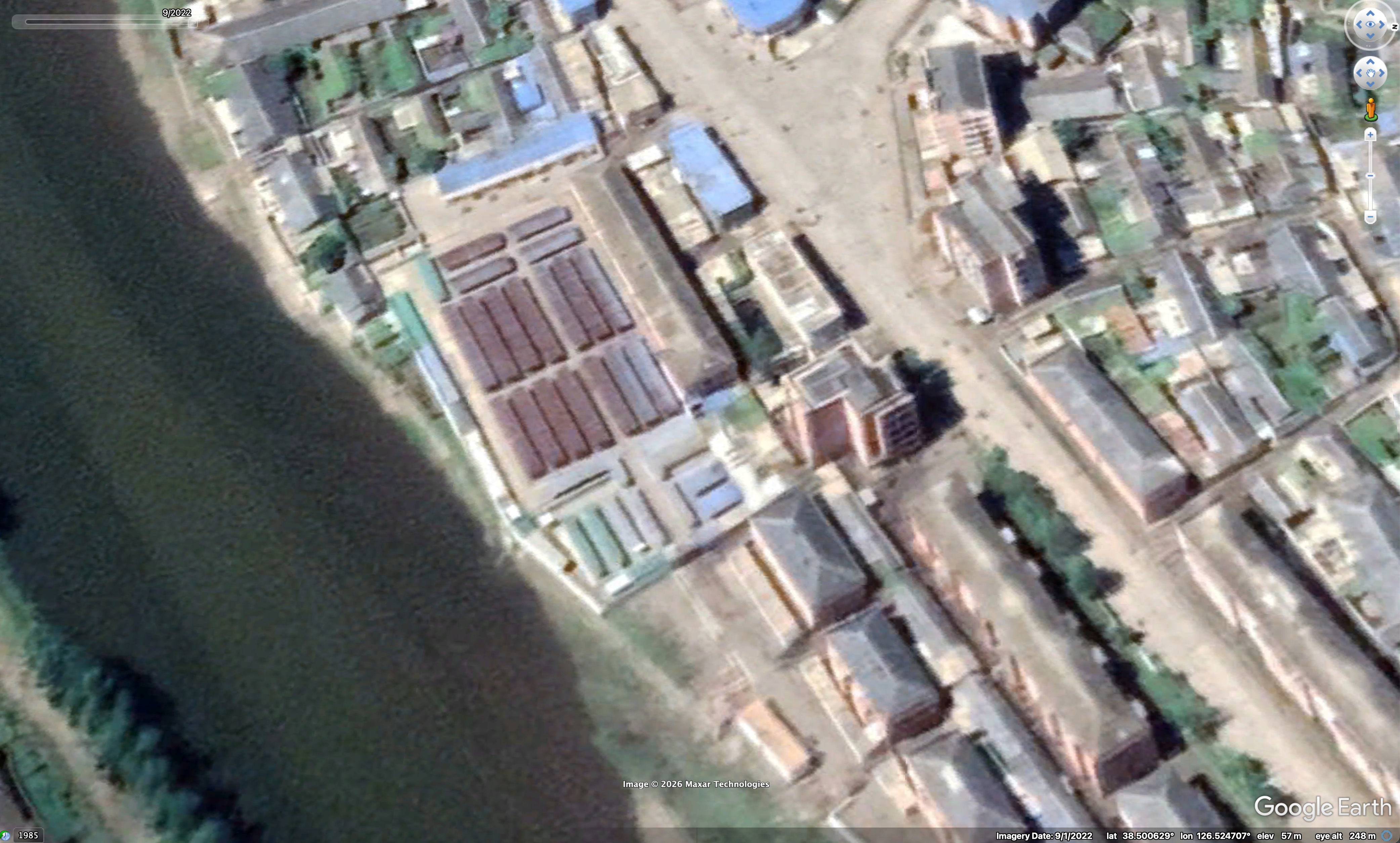
Various villages along the river leading west into the center of Singye were either entirely wiped out by the flowing water or quickly razed by recovery crews. The precise sequence of events is unclear as cloudy weather prevented clearer imagery until at least a week after the floods. The neighborhoods of homes directly in front of the military headquarters in Singye and across the river on an island, likely housing key personnel running the base, also disappeared and now appear as a uniform layer of dirt. Medium-resolution imagery suggests the compound was flooded as well, but buildings remained intact as of Aug. 5 and higher-resolution imagery is needed to determine the level of damage. Further west along the river, a large equestrian center associated with the military headquarters was also wiped away, as well as more neighborhoods of homes and the main town market. State media has not acknowledged the apparent tragedy, but satellite imagery taken between July 28 and Aug. 5 shows what appears to be camps of blue and orange tents in the areas of the destroyed homes in Singye, likely representing government-led recovery efforts. State-run Korean Central Television (KCTV) reported on July 21 that Singye received 264.7mm of rainfall since the previous day and 207mm more on July 23. Singye did not reportedly experience the most rain compared to other counties, but it did appear to suffer the most damage, likely due at least in part to human error in the construction or maintenance of the dam that was built in 2015. Major floods previously occurred around the July 27 Korean War holiday in 2024, when landslides wiped out an entire village and an overflowing river submerged islands on the Chinese border. Kim at the time visited some of the disaster sites in the days after the floods and castigated officials for failing to give proper warnings and prevent damage to over 4,000 homes and 7,000 acres of farmland. SINGYE MILITARY BASE While the current identity of the base in central Singye has not been confirmed in open-source resources, NK Pro analysis suggests it is a high-level Korean People’s Army (KPA) administrative headquarters. Some features added since 2020 are similar to that of most corps command headquarters, like the large horse track and a paved strip for military parade marching practices, but it does not have statues of the former leaders. A declassified U.S. military document from 1985 published online at the CIA Freedom of Information Act Electronic Reading Room described a “new artillery corps” with “a headquarters, three self-propelled artillery brigades, and one possible mixed artillery brigade” that was established in Singye between Oct. 1982 and March 1983. It said the “corps headquarters and associated support units are at Singye,” presumably referring to the county seat, and that “the self-propelled artillery brigades are at Pyongsan, [Chiha-ri], and immediately southwest of Singye.” 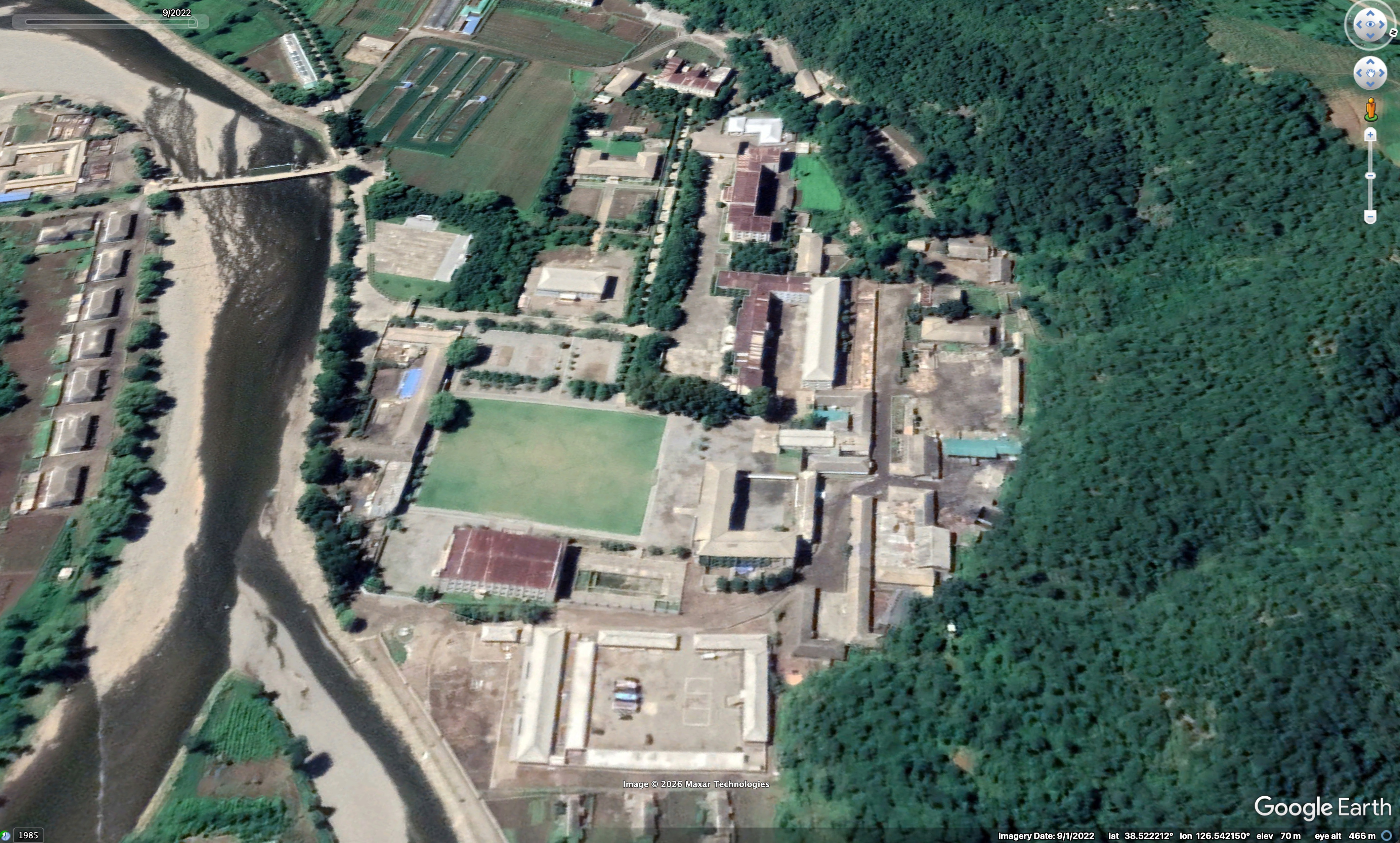 Old Landsat imagery taken in the early 80s shows that the apparent headquarters in the main population center of Singye was indeed constructed in the described period, lining up with the description of the artillery corps command’s location. Unconfirmed reports in South Korean media have long called the headquarters in Singye the “620th Artillery Corps” (제620포병군단) or “620th Training Center” (제620훈련소), saying it functions as the artillery command for the entire North Korean army. North Korea has promoted a range of artillery developments in recent years, including 240mm multiple-launch rocket systems (MLRS), a 155mm self-propelled gun-howitzer and 600mm “long-range” MLRS. Pyongyang claims 600mm systems, also known as the KN-25, can be equipped with nuclear warheads and have been deployed to southern border units. If the Singye headquarters maintains a corps-level role connected to artillery forces, the flooding has likely had a significant impact on operations and wartime response capabilities. 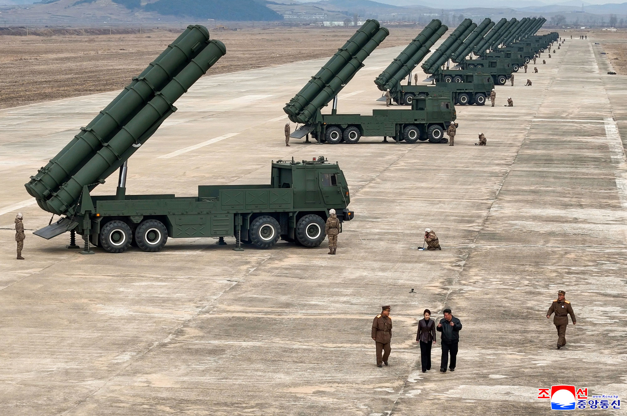 
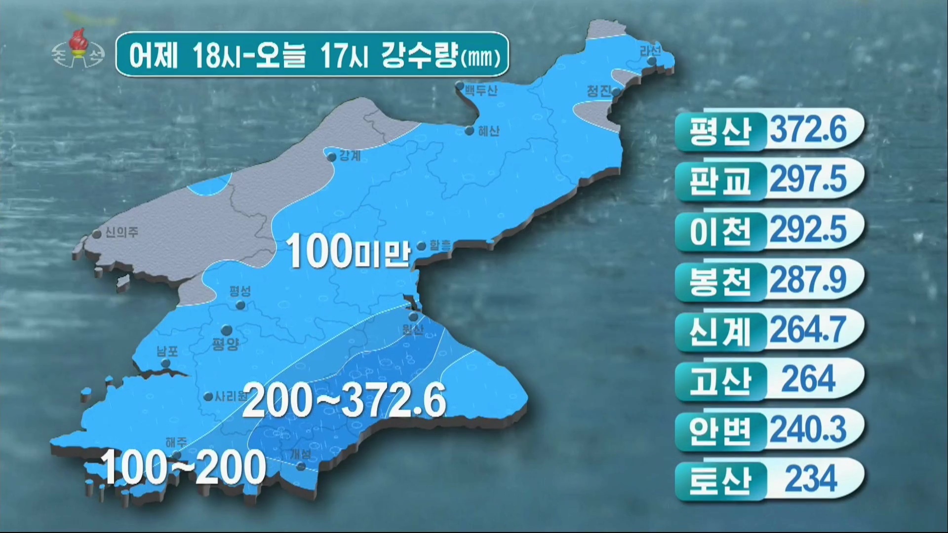
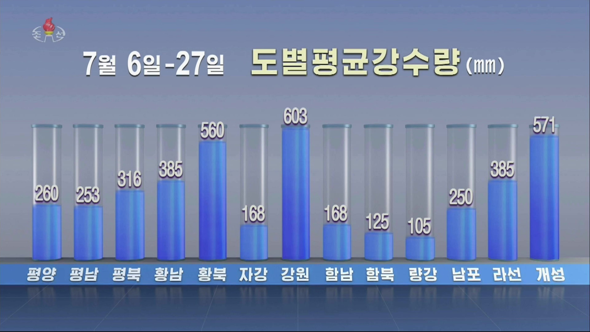
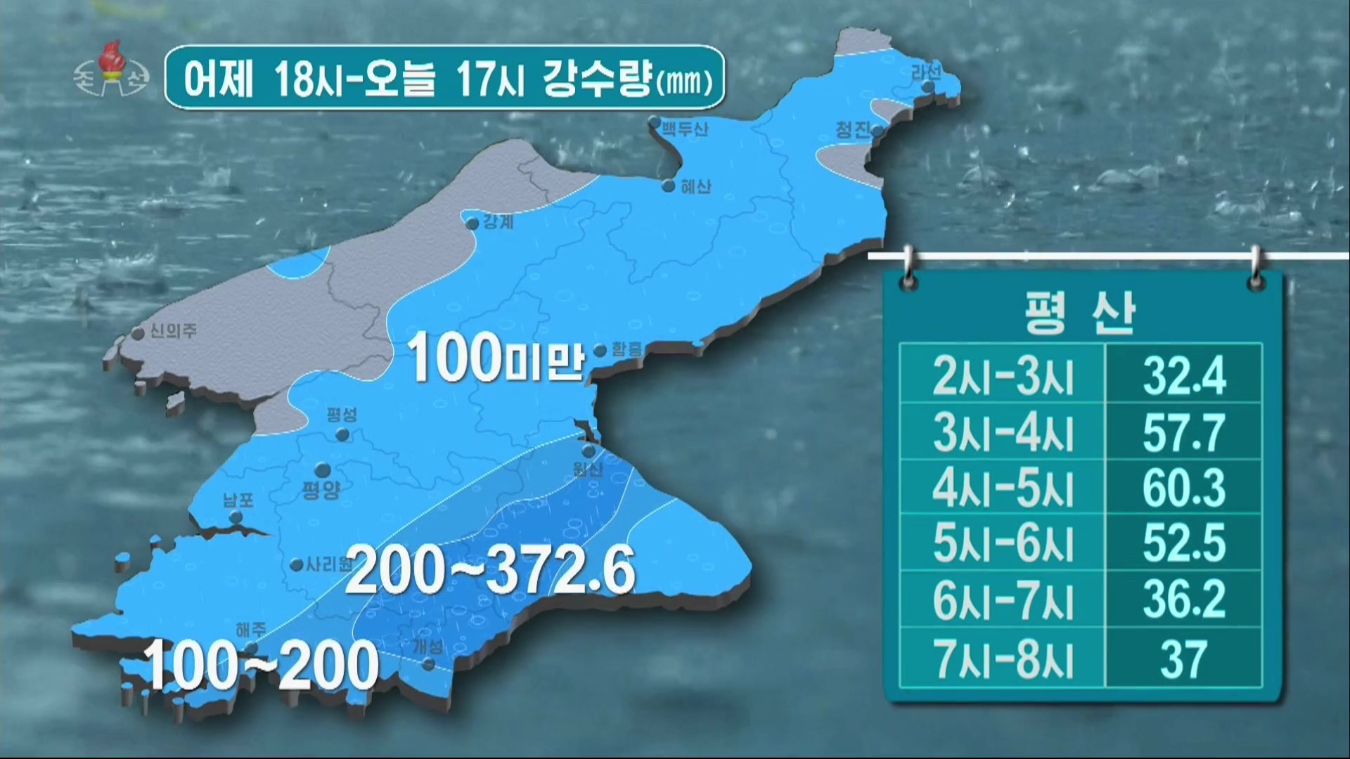
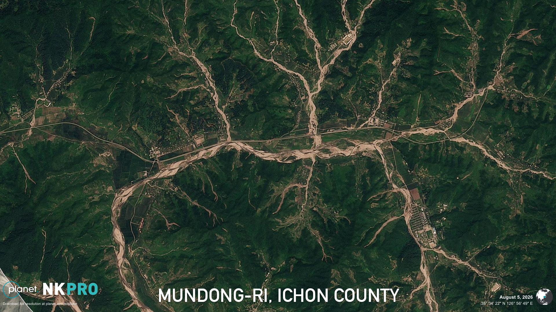
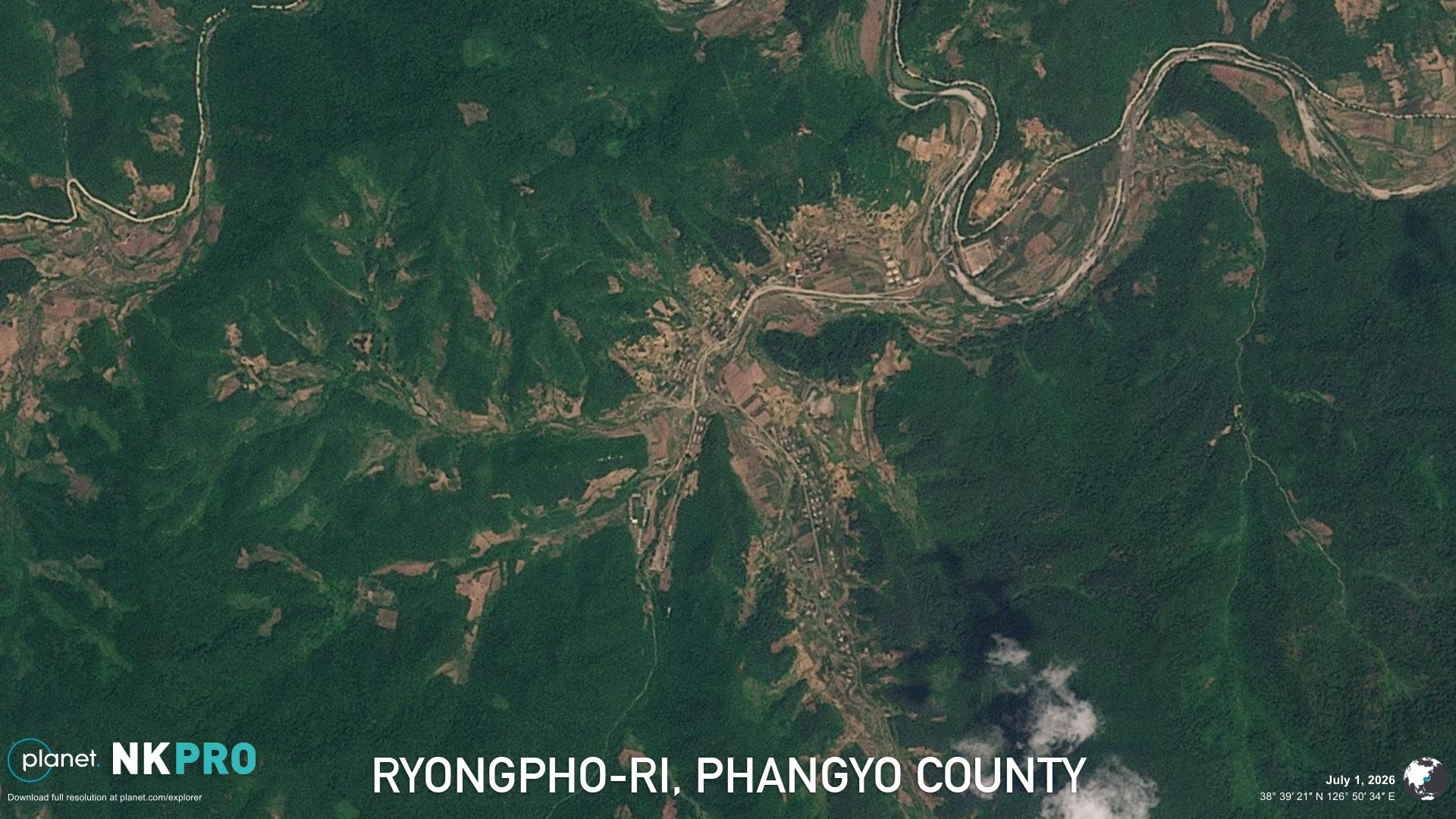
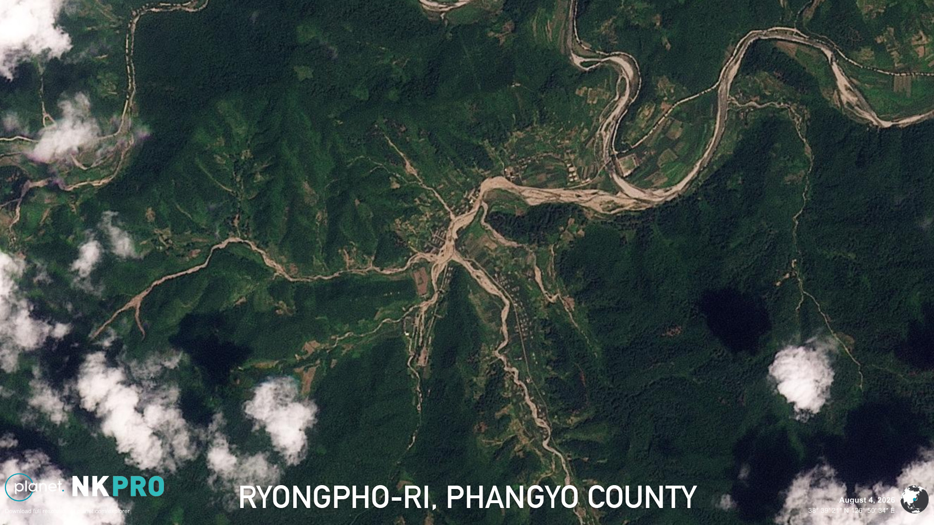
OTHER FLOODING KCTV reported higher precipitation between July 23 and 25 in areas surrounding Singye like Sohung, Kumchon, Thousand, Cholwon, Pongchon and Phangyo. It also suggested Phyongsan was the hardest hit area during heavy storms on July 21, and the city of Kaesong alone received 571mm of rainfall between July 6 and 27. NK Pro analysis of Planet Labs imagery shows that of these, the densely mountainous areas of northern Ichon and southern Phangyo counties experienced the most visible destruction from the storms, while the rest of the counties didn’t exhibit signs of large-scale damage. For example, several homes in Mundong-ri of Ichon County, near the border with Phangyo, appeared to be flooded, while signs of mudslides appeared on the mountains surrounding the village. Several homes and roads appeared to be damaged from flooding and landslides in the village of Ryongpho-ri in southwestern Phangyo as well. It is likely that dozens of homes were damaged by the storms and numerous communities affected by damaged roads in the narrow valleys throughout the region. 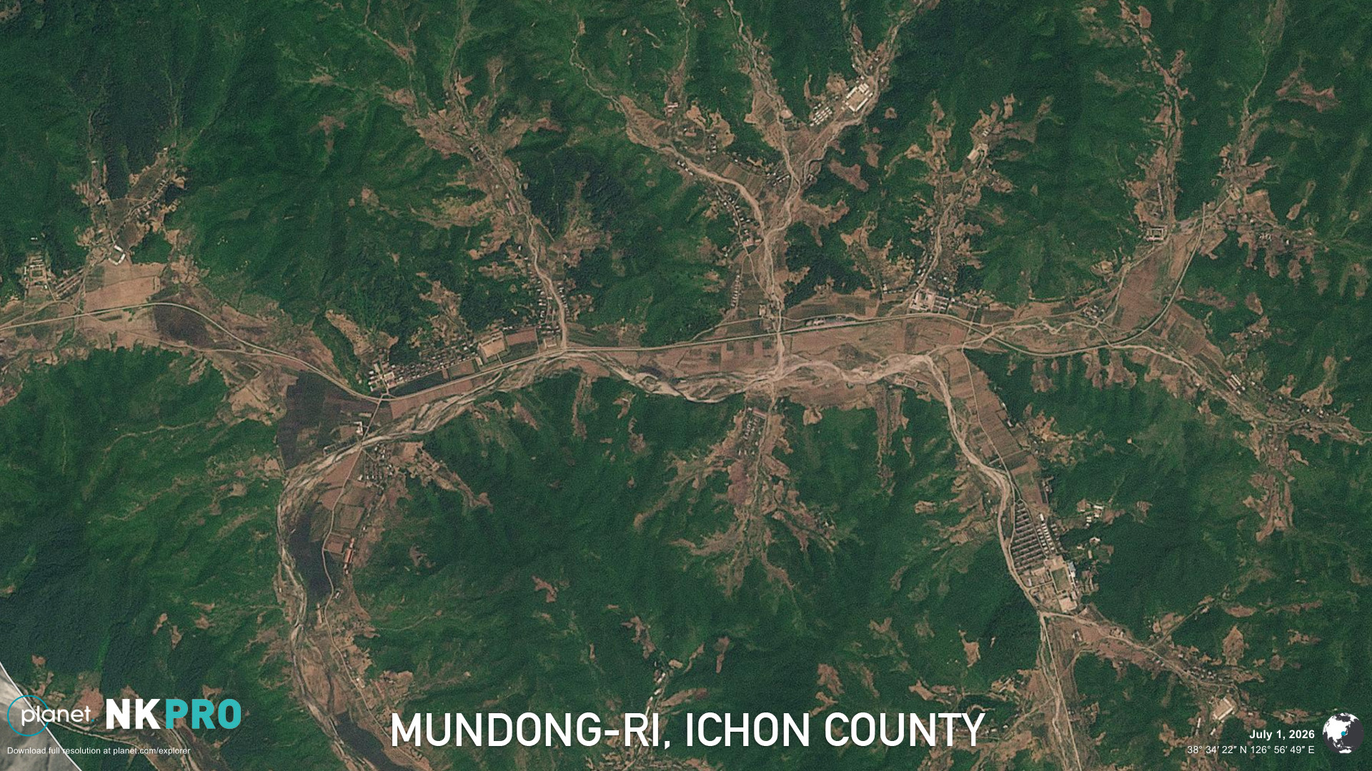
Edited by David Choi © Korea Risk Group. All rights reserved. |

October 07, 2026Oct 07, 2026

The ultimate resources for professionals working on North Korea
 SHARE
SHARE COPY LINK
 X
X MASTODON